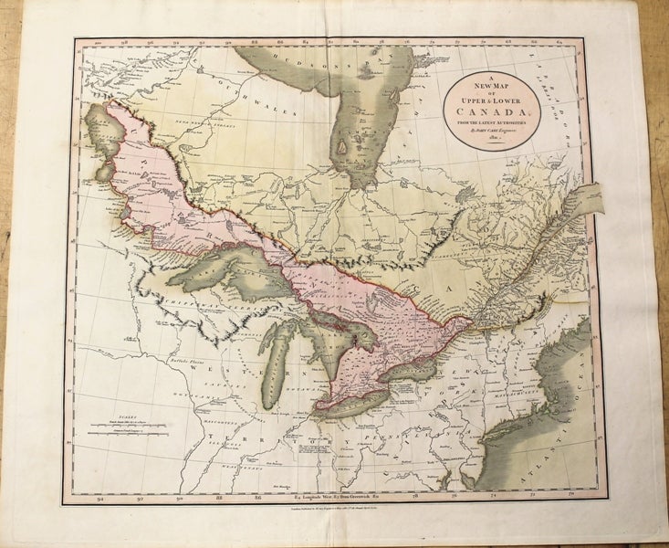
A New Map of Upper & Lower Canada
London: J. Cary Engraver & Map Seller, 1811. Notes: Cary's new universal atlas, containing distinct maps of all the principal states and kingdoms throughout the World. From the latest and best authorities. London: Printed for J. Cary, Engraver and Map-seller, No. 181, near Norfolk Street, Strand, 1808.
The atlas was reissued in 1811, 1819 (one third of the maps amended), 1824 (maps unchanged from 1819 except for the date), 1828 (same as 1824, except for date changes, with reissues in 1833, 1836 (Baskes), and 1844). This is a fine and important atlas, one of the best of its period, and a source for American mapmakers (Tanner directly copied the World and continental maps for his New American Atlas). Fordham: (The maps) "are finely engraved, with full details, showing especially the water-ways and roads, and hill-shading, and are usually coloured. The work is very clear and delicate and of a uniform character throughout., Size : 455x510 (mm), 17.91x20.08 (Inches), Coloring: Original Hand Coloring, Reference: Winearls, J. Mapping Upper Canada 1780-1867, 35; Phillips. Maps of America, p. 194., Category: Maps Canada;Maps North America Great Lakes;. Very Good. Item #M3876
Notes: Cary's new universal atlas, containing distinct maps of all the principal states and kingdoms throughout the World. From the latest and best authorities. London: Printed for J. Cary, Engraver and Map-seller, No. 181, near Norfolk Street, Strand, 1808.
The atlas was reissued in 1811, 1819 (one third of the maps amended), 1824 (maps unchanged from 1819 except for the date), 1828 (same as 1824, except for date changes, with reissues in 1833, 1836 (Baskes), and 1844). This is a fine and important atlas, one of the best of its period, and a source for American mapmakers (Tanner directly copied the World and continental maps for his New American Atlas). Fordham: (The maps) "are finely engraved, with full details, showing especially the water-ways and roads, and hill-shading, and are usually coloured. The work is very clear and delicate and of a uniform character throughout., Size : 455x510 (mm), 17.91x20.08 (Inches), Coloring: Original Hand Coloring, Reference: Winearls, J. Mapping Upper Canada 1780-1867, 35; Phillips. Maps of America, p. 194., Category: Maps Canada;Maps North America Great Lakes;.
Price: $950.00