
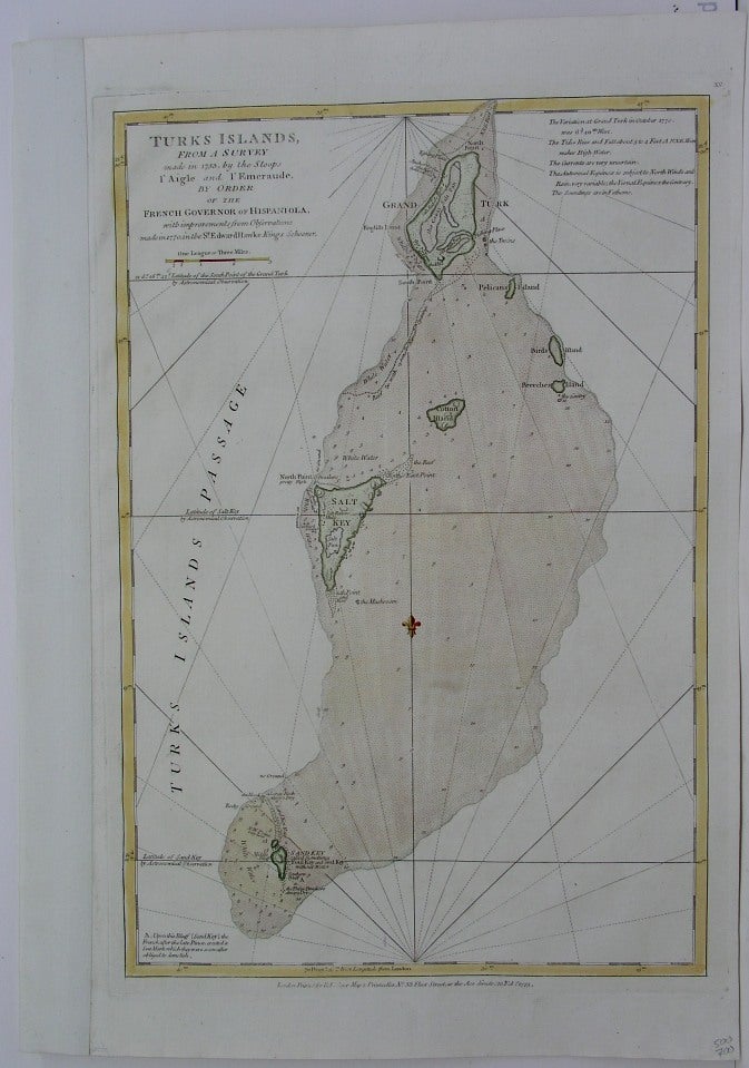
Turks Islands, from a Survey made in 1753, by the Sloops l'Aigle and l'Emeraude, by Order of the French Governor of Hispaniola, with improvements from Observations made in 1770, in the Sr. Edward Hawke King's Schooner
London: Sayer, Robert, 1775. Notes: Taken from "The West-India atlas: or, a compendious description of the West-Indies" illustrated with forty one correct charts and maps, taken From actual surveys. Together with an historical account of the several countries and islands which compose that part of the world. Engraved nautical chart, showing swamps, sailing course, etc. Relief shown pictorially; depths by soundings., Size : 480x333 (mm), 18.875x13.125 (Inches), Coloring: Hand Colored, Category: Maps West Indies Other Islands;. Excellent. Item #M3005
Notes: Taken from "The West-India atlas: or, a compendious description of the West-Indies" illustrated with forty one correct charts and maps, taken From actual surveys. Together with an historical account of the several countries and islands which compose that part of the world. Engraved nautical chart, showing swamps, sailing course, etc. Relief shown pictorially; depths by soundings., Size : 480x333 (mm), 18.875x13.125 (Inches), Coloring: Hand Colored, Category: Maps West Indies Turks and Caicos Islands.
Price: $750.00