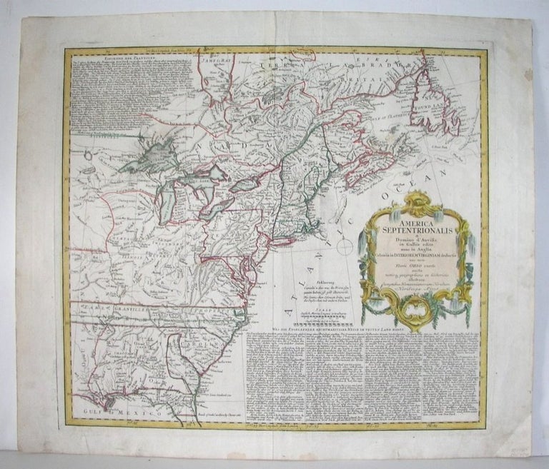
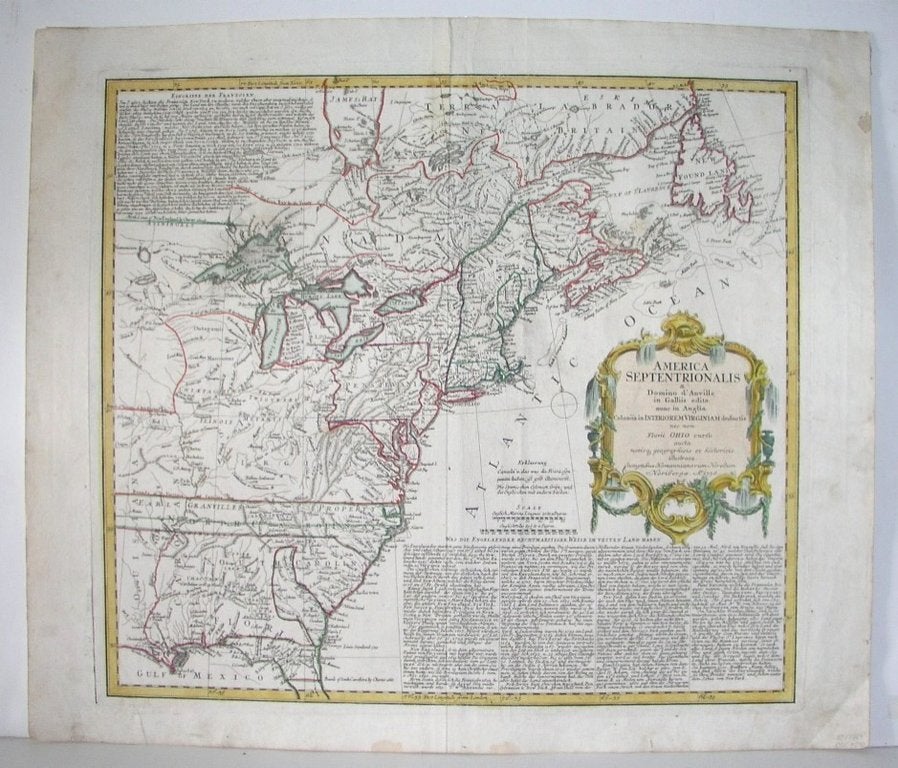
America Septentrionalis a Domino d'Anville in Galliis edita nunc in Anglia Coloniis in Interiorem Virginiam deductis nex non Fluvii Ohio cursu aucta notisq3 geographicis et historicis illustrata
Nuremberg: 1756. Notes: First German edition of this important map of the French-Indian war. There were many later editions, until 1790.
"Covers the area east of the Mississippi River from James Bay to the Gulf of Mexico. Shows the English colonies in North America, towns and cities, Indian villages and tribal territoty, forts, and relief. Includes references, historical notes, and a text in German concerning British and French territorial claims. Place-names are in English" -Sellers & Van Ee
"This is the Homann Heirs copy of the Jefferys map of the previous year. Map was later reissued with several alterations: 'et ad bellum praesentis temporis accomodata' added before imprint information, and date changed to 1777." -McCorkle, Size : 470x526 (mm), 18.5x20.75 (Inches), Coloring: Original Outline Coloring, Reference: McCorkle 756.1; Sellers and Van Ee 68, Category: ; Maps North America Great Lakes; Maps United States East; Maps United States New England. Very Good; two spots of thinning of the paper on the upper part of the map. Item #M2899
Notes: First German edition of this important map of the French-Indian war. There were many later editions, until 1790.
"Covers the area east of the Mississippi River from James Bay to the Gulf of Mexico. Shows the English colonies in North America, towns and cities, Indian villages and tribal territoty, forts, and relief. Includes references, historical notes, and a text in German concerning British and French territorial claims. Place-names are in English" -Sellers & Van Ee
"This is the Homann Heirs copy of the Jefferys map of the previous year. Map was later reissued with several alterations: 'et ad bellum praesentis temporis accomodata' added before imprint information, and date changed to 1777." -McCorkle, Size : 470x526 (mm), 18.5x20.75 (Inches), Coloring: Original Outline Coloring, Reference: McCorkle 756.1; Sellers and Van Ee 68, Category: ; Maps North America Great Lakes; Maps United States East; Maps United States New England.
Price: $1,250.00