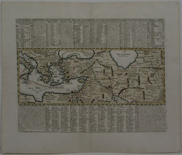
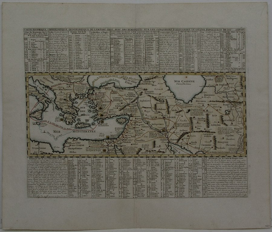
Carte Historique, Cronologique, Geographique de l'Empire Grec, Avec des remarques sur les conquestes d'Alexandre le Grand fondateur de cette Empire
Amsterdam: 1719. Notes: Historical map of the ancient World depicting the Persian and Greek empires., Size : 337x440 (mm), 13.25x17.25 (Inches), Coloring: Hand Colored, Category: Maps Mediterranean Sea; Maps Asia Middle East;. Excellent. Item #M2868
Notes: Historical map of the ancient World depicting the Persian and Greek empires., Size : 337x440 (mm), 13.25x17.25 (Inches), Coloring: Hand Colored, Category: Maps Mediterranean Sea; Maps Asia Middle East;.
Price: $575.00
See all items by Henri Chatelain