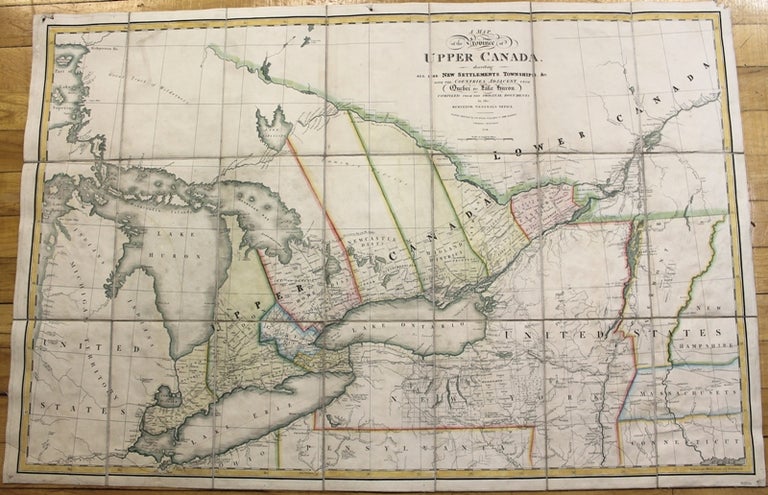
A map of the Province of Upper Canada describing all the New Settlements, Townships, &c. With the countries adjacent, from Quebec to Lake Huron.
London: Wyld, James, c.1838. Notes: This is an important and early map of Upper Canada with districts and counties shown. Map is compiled and corrected from the latest surveys in the Surveyor General\'s Office. It focuses on the Great Lakes, extending from Lake Superior and Lake Michigan in the West to Quebec City and New Hampshire to the East. Also, Upper New York state is depicted in detail. It is a finely engraved and nicely colored map.
, Size : 600x910 (mm), 23.625x35.75 (Inches), Coloring: Original Hand Coloring, Category: Maps Canada Ontario;Maps United States East New York;. Very Good, folding map dissected and laid down on original canvas. Item #M239
Notes: This is an important and early map of Upper Canada with districts and counties shown. Map is compiled and corrected from the latest surveys in the Surveyor General\'s Office. It focuses on the Great Lakes, extending from Lake Superior and Lake Michigan in the West to Quebec City and New Hampshire to the East. Also, Upper New York state is depicted in detail. It is a finely engraved and nicely colored map.
, Size : 600x910 (mm), 23.625x35.75 (Inches), Coloring: Original Hand Coloring, Category: Maps Canada Ontario;Maps United States East New York;.
Price: $2,500.00