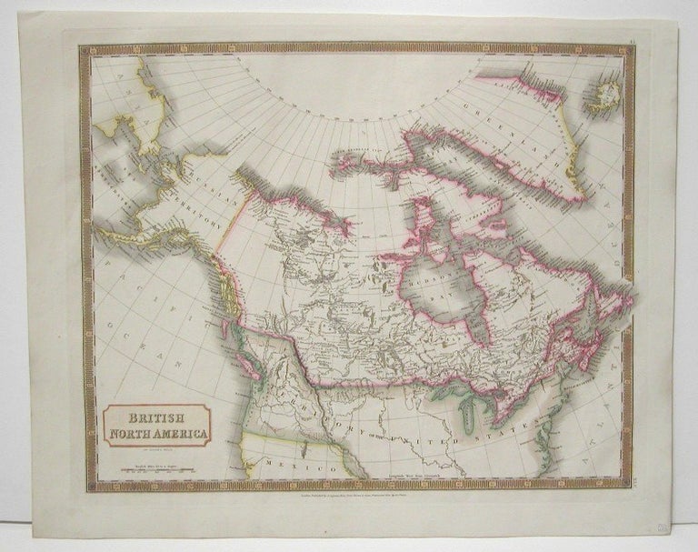
British North America.
London: Longman, Rees, Orme, Brown & Green, 1829. Notes: Handsome map of Canada and Arctic Regions of North America in strong period hand coloring. Arctic exploration’s interest was high at the time in the British isles.
The map shows rivers, settlements, territories of First Nations peoples.
British Columbia is divided into New Norfolk, New Cromwell, New Hanover, and New Georgia. (the southern portion of which was still called Washington State).
Western Canada is illustrated with details based on early explorers. Early forts and trading houses are depicted
, Size : 438x535 (mm), 17.25x21 (Inches), Coloring: Original Hand Coloring, Category: ; Maps Canada. Excellent. Item #M1448
Notes: Handsome map of Canada and Arctic Regions of North America in strong period hand coloring. Arctic exploration’s interest was high at the time in the British isles.
The map shows rivers, settlements, territories of First Nations peoples.
British Columbia is divided into New Norfolk, New Cromwell, New Hanover, and New Georgia. (the southern portion of which was still called Washington State).
Western Canada is illustrated with details based on early explorers. Early forts and trading houses are depicted
, Size : 438x535 (mm), 17.25x21 (Inches), Coloring: Original Hand Coloring, Category: ; Maps Canada.
Price: $750.00