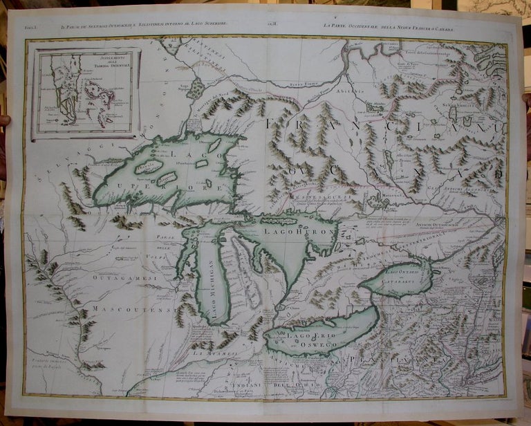
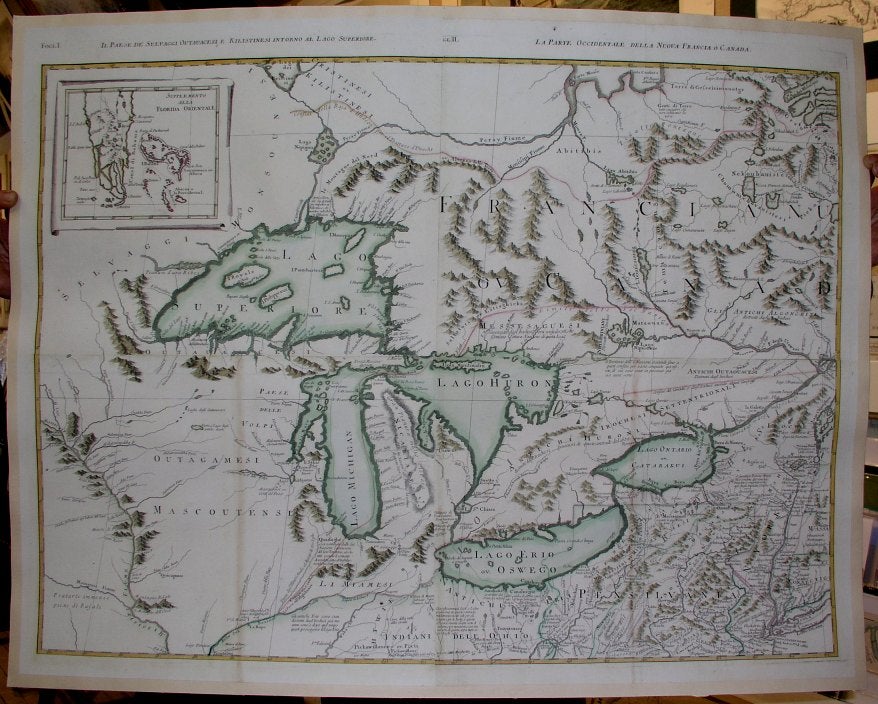
La Parte Occidentale Della Nuova Francia O Canada…
Venice: 1778. Notes: A stunning and attractive four-sheet, large scale map of the Great Lakes, put together and laid down on acid-free canvas for long term presevation. This set of maps of the Great Lakes from the North American section of Zatta's "Atlante Novissimo", one of the major Italian atlases of the 18th century, are based on Mitchell's important map of 1755 (with updates such as a reference to Bourgoyne's defeat at Saratoga, among others). Mitchell's work was the most influential map of North America made in the 18th century. There were twenty-one editions of Mitchell's map published between 1755 and 1781. Though it was first published in 1755, it was used by negotiators in Paris in 1783 to determine the boundaries of the new United States. It is interesting to note that Zatta's derivative was published in 1778., Size : 640x860 (mm), 25.125x33.875 (Inches), Coloring: Original Outline Coloring, Reference: Portinaro & Knirsch pages 262-270, Category: ; Maps North America Great Lakes. Very Good, backed on acid free canvas for long term preservation. Item #M1252
Notes: A stunning and attractive four-sheet, large scale map of the Great Lakes, put together and laid down on acid-free canvas for long term presevation. This set of maps of the Great Lakes from the North American section of Zatta's "Atlante Novissimo", one of the major Italian atlases of the 18th century, are based on Mitchell's important map of 1755 (with updates such as a reference to Bourgoyne's defeat at Saratoga, among others). Mitchell's work was the most influential map of North America made in the 18th century. There were twenty-one editions of Mitchell's map published between 1755 and 1781. Though it was first published in 1755, it was used by negotiators in Paris in 1783 to determine the boundaries of the new United States. It is interesting to note that Zatta's derivative was published in 1778., Size : 640x860 (mm), 25.125x33.875 (Inches), Coloring: Original Outline Coloring, Reference: Portinaro & Knirsch pages 262-270, Category: ; Maps North America Great Lakes.
Price: $5,000.00