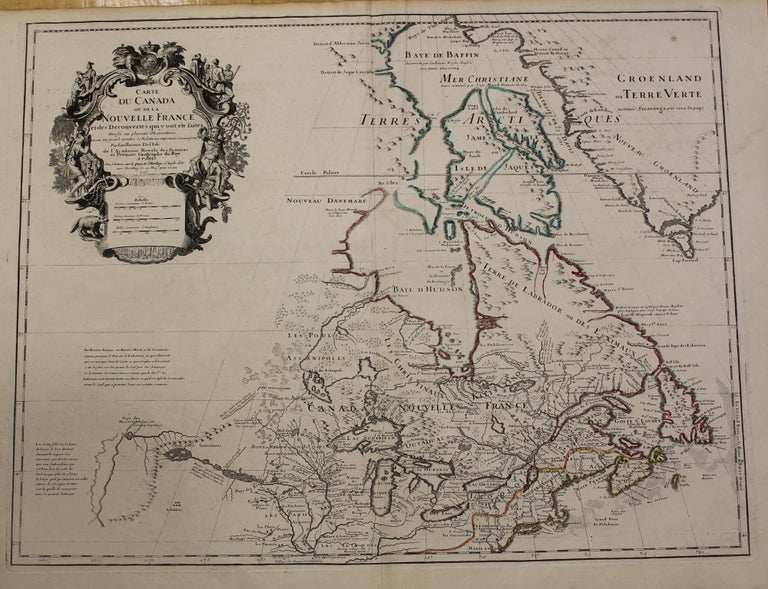
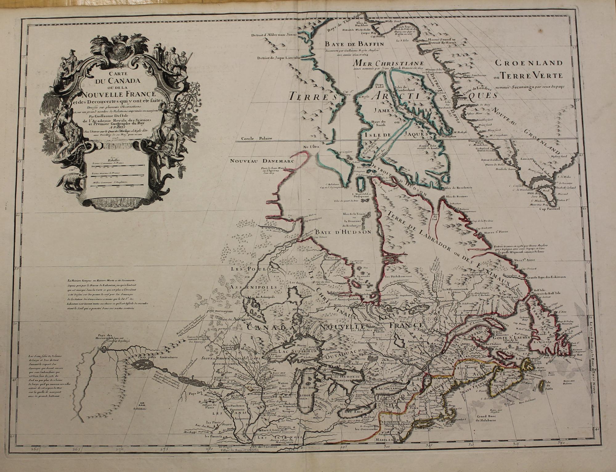
Carte du Canada ou de la Nouvelle France et des Decouvertes qui y ont ete faites...
Paris: 1703 but 1718. Notes: Fifth State. Scarce.
"Del'Isle's map of Canada is one of the most outstanding maps of Canada of the 17th and early 18th centuries. Typical of all of his work, the information that went into his map of Canada was the result of careful and painstaking research. It thus seems somewhat surprising that the dubious discoveries of Lahontan should have been so readily accepted and included on his map of Canada. Del'Isle's careful research resulted in the first map of Canada to present the whole of the Great Lakes correctly. In addition, the position of the lakes relative to Hudson Bay is also correct, and the Avalon Peninsula is shown much more realistically than in previous maps of Canada. Of considerable significance, the geography of the coastal regions of James and Hudson Bays, together with their major river systems is presented b Del'Isle with a surprising degree of accuracy."-Kershaw I page 275., Size : 510x660 (mm), 20.125x26 (Inches), Coloring: Original Outline Coloring, Reference: Kershaw 312., Category: Maps Canada; Maps North America Great Lakes;. Very Good. Item #M1121
Notes: Fifth State. Scarce.
"Del'Isle's map of Canada is one of the most outstanding maps of Canada of the 17th and early 18th centuries. Typical of all of his work, the information that went into his map of Canada was the result of careful and painstaking research. It thus seems somewhat surprising that the dubious discoveries of Lahontan should have been so readily accepted and included on his map of Canada. Del'Isle's careful research resulted in the first map of Canada to present the whole of the Great Lakes correctly. In addition, the position of the lakes relative to Hudson Bay is also correct, and the Avalon Peninsula is shown much more realistically than in previous maps of Canada. Of considerable significance, the geography of the coastal regions of James and Hudson Bays, together with their major river systems is presented b Del'Isle with a surprising degree of accuracy."-Kershaw I page 275., Size : 510x660 (mm), 20.125x26 (Inches), Coloring: Original Outline Coloring, Reference: Kershaw 312., Category: Maps Canada; Maps North America Great Lakes;.
Price: $3,750.00