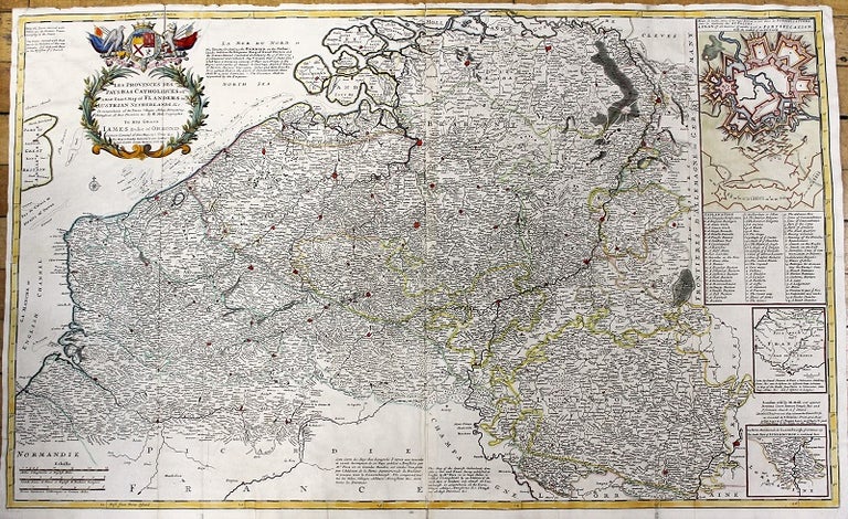
Les Provinces Des Pays-Bas Catholiques ou A Most Exact Map of Flanders or ye Austrian Netherlands & c.
London: J. & T. Bowles, c.1720. Notes: Large and detailed map of the Netherlands by Herman Moll (1654-1732). It referrers to the Austrian Netherlands; Austria was given the Netherlands in the treaty of Utrecht (signed in 1712). The map has three inset maps: A Plan of all manner of works used in Fortification with the method of an Attack. A Map of the Roads from Paris to Valenciene. The South Part of Luxembourgh., Size : 617x1002 (mm), 24.29x39.45 (Inches), Coloring: Hand Colored, Category: Maps Europe Benelux;. Very Good, backed on original linen. Item #M11033
Price: $600.00
See all items by Herman Moll