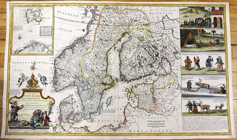
A New Map of Denmark and Sweden. According to ye Newest & most Exact Observations...To His Excellency Lord Bishop of Bristol Ld. Privy Seal & Her Majestys Plenipotentiary...
London: J. & T. Bowles, c.1720. Notes: Large and detailed map of Scandinavia by Herman Moll (1654-1732). With inset map: The North Part of Norway, Lapland and Greenland. Five inset views showing life of Laplanders. , Size : 620x1027 (mm), 24.41x40.43 (Inches), Coloring: Hand Colored, Category: Maps Europe Scandinavia Whole;. Very Good, with some skillful restorations; backed on acid free tissue paper for long term preservation. Item #M11029
Price: $2,000.00
See all items by Herman Moll