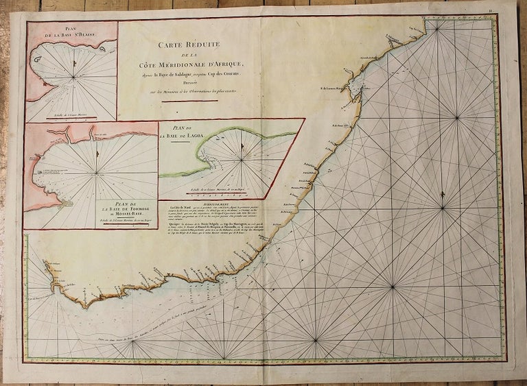
Carte Reduite De La Cote Meridionale D'Afrique.
Paris: c.1775. Notes: Map of South Africa, with inset maps: Plan De La Baye St. Blaise. Plan De La Baye De Formose ou Mossel-Baye. Plan De La Baye De Lagoa.
Jean-Baptiste-Nicolas-Denis d'Après de Mannevillette (1707–1780) was a French sailor and hydrographer, and captain of the Compagnie des Indes. Mannevillette apprenticed under the great royal cartographer Guillaume De L'Isle. His charting work, published in Neptune Oriental was a major achievement in mapping and a exceptional resource to sailors traveling the Indian Ocean and Asia. He was maticulous in updating his information so the second edition of this work truly had some of the most accurate cartography of the century. He was one of the first navigators to use Hadley's revolutionary octant in taking measurements at sea., Size : 497x680 (mm), 19.57x26.77 (Inches), Coloring: Hand Colored, Category: Maps Africa South;. Very Good. Item #M10933
Price: $375.00