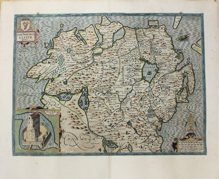
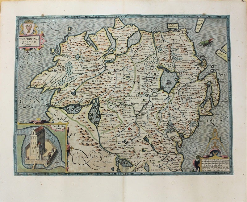
The Province Ulster described.
London: 1627. Notes: John Speed map of The Province Ulster in Northern Ireland, with an inset showing Enis Kelling Fort (Fort of Enniskillen).
John Speed was a renown British cartographer, 'Theatre of Great Britain' was the first atlas of the British Isles., Size : 382x515 (mm), 15.04x20.28 (Inches), Coloring: Hand Colored, Category: Maps Europe Ireland;. Good, backed on acid free tissue paper for long term preservation. Item #M10918
Price: $1,750.00
See all items by John Speed