
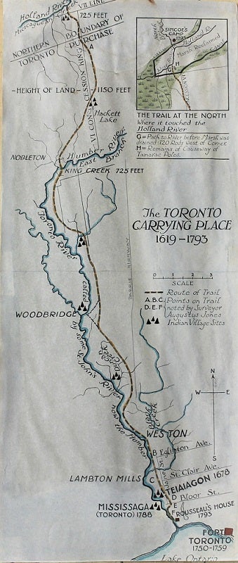
The Toronto Carrying Place 1619-1793
The Trail at the North Where it touched the Holland River.
Toronto: J. Robinson, 1933. Notes: The Toronto Carrying-Place Trail, also known as the Humber Portage and the Toronto Passage, was a major portage route in Ontario, Canada, linking Lake Ontario with Lake Simcoe and the northern Great Lakes.
"Map of the Toronto Carrying Place (1619-1793), which was the portage route from the Holland Marsh to Lake Ontario. The map is the work of C.W. Jeffreys, first published in Percy J. Robinson's "Toronto during the French Regime" (Ryerson Press: Toronto, 1933). The map includes the trail's route, the sites of Native Canadian villages, and a number of rivers."
, Size : 438x189 (mm), 17.24x7.44 (Inches), Coloring: Hand Colored, Category: Maps Canada Ontario South Toronto;. Very Good. Item #M10872
Price: $375.00