
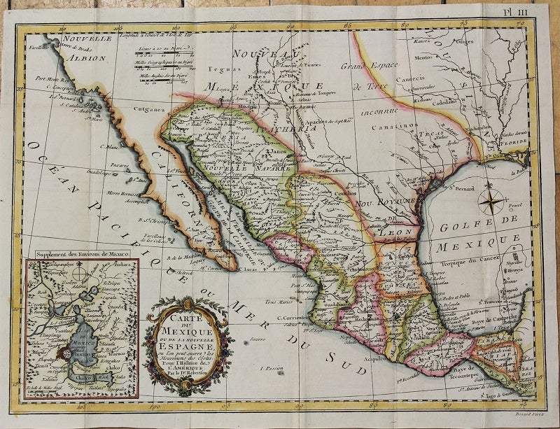
Carte Du Mexique ou De La Nouvelle Espagne...
Paris: c.1780. Notes: Map of New Spain, areas of Indian habitation; general layout of Mexico City and it's surrounding area. It covers Texas, New Mexico, and parts of California, Louisiana, and Mexico., Size : 283x380 (mm), 11.14x14.96 (Inches), Coloring: Hand Colored, Category: Maps Central America Mexico; Maps United States West California; Maps United States South Texas;. Very Good. Item #M10823
Price: $475.00
See all items by William Robertson