
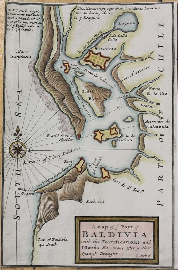
A Map of Ye Port of Baldivia with the Fortifications and Islands & c. Done after a New Spanish Draught.
London: 1711. Notes: Map of Port of Baldivia, on the west coast of South America. , Size : 217x139 (mm), 8.54x5.47 (Inches), Coloring: Hand Colored, Category: Maps South America Countries;. Very Good, margins trimmed. Item #M10814
Price: $375.00
See all items by Herman Moll