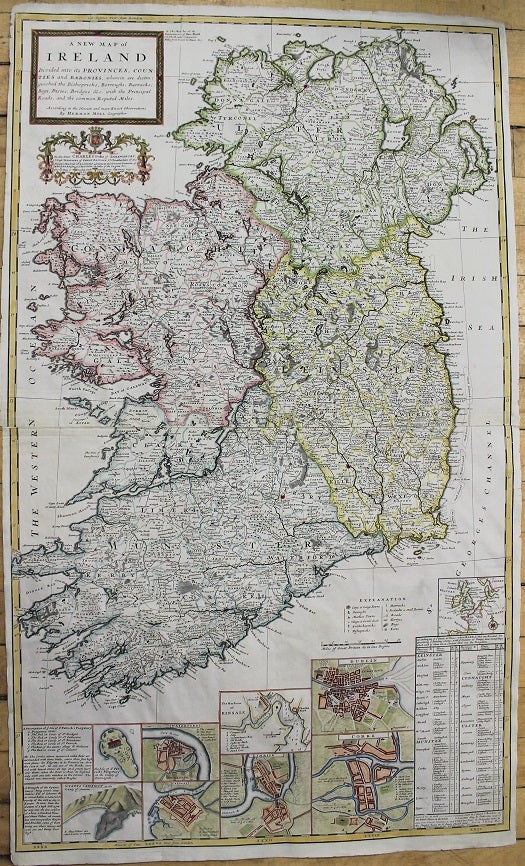
A New Map of Ireland Divided into its Provinces, Counties and Baronies, wherein are distinguished the Bishopricks, Borroughs, Barracks, Bogs, Passes, Bridges & c. with the Principal Roads, and the common Reputed Miles.
London: J. & T. Bowles, 1714. Notes: Large and detailed map of Ireland with inset plans of: Dublin, Corke, Limrick, Waterford and Gallway, Kinsale Harbour, the Giant's Causeway.
With a dedication to Charles Talbot, Duke of Shrewsbury, with an elaborate cartouche surmounted by his arms. Shrewsbury served as Lord Lieutenant of Ireland between 1710 and 1714, was recalled that year to court and appointed Lord High Treasurer by Queen Anne on her deathbed., Size : 1013x612 (mm), 39.88x24.09 (Inches), Coloring: Hand Colored, Category: Maps Europe Ireland;. Very Good, two sheets joined. Item #M10813
Price: $2,500.00
See all items by Herman Moll