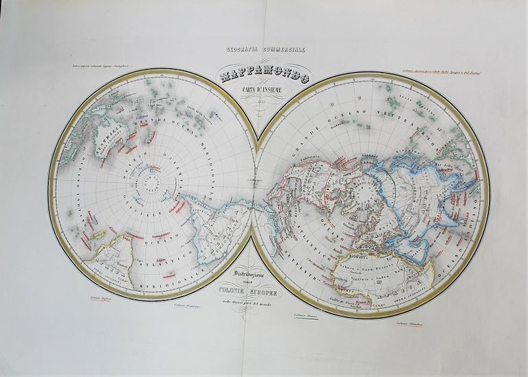
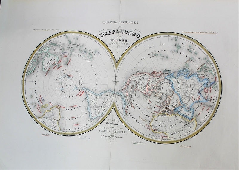
Mappa Mondo Carta D'Insieme 1855 Distribuzione Delle Colonie Europee.
Torino, Italy: c.1858. Notes: Map of World showing Antarctic and Arctic regions published in scarce Italian atlas: Geografia Commerciale., Size : 258x386 (mm), 10.16x15.20 (Inches), Coloring: Original Outline Coloring, Category: Maps Polar Antarctic Regions; Maps Polar Arctic Regions; Maps World;. Very Good. Item #M10790
Notes: Map of World showing Antarctic and Arctic regions published in scarce Italian atlas: Geografia Commerciale., Size : 258x386 (mm), 10.16x15.20 (Inches), Coloring: Original Outline Coloring, Category: Maps Polar Antarctic Regions; Maps Polar Arctic Regions; Maps World;.
Price: $275.00
See all items in
Maps
See all items by Francesco Marmocchi, G. Bonatti