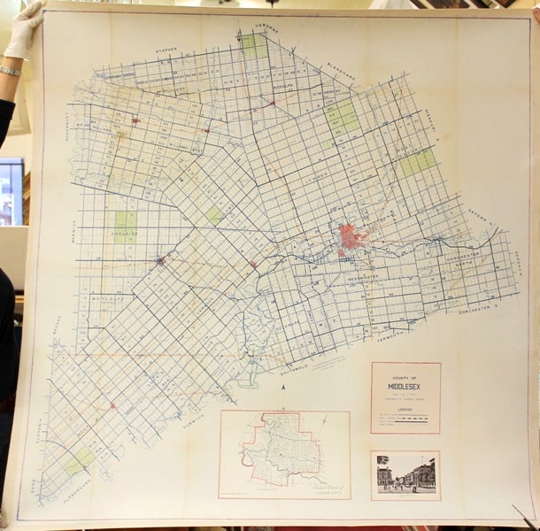
County of Middlesex
London, Ontario: Government of Ontario, 1901. Notes: Large scale and attractive wall map of the County of Middlesex published at the turn of the 20th century. The map shows highways, county sub-urban roads, county roads, Indian reserves, major cities, train lines & rivers and parks. The map also has two insets city map of London Ontario and a view of downtown London Ontario., Size : 1330x1280 (mm), 52.36x50.39 (Inches), Coloring: Hand Colored, Category: Maps Canada Ontario South; Maps Wall Maps;. Very Good, backed on acid free canvas for long term preservation. Item #M10644
Notes: Large scale and attractive wall map of the County of Middlesex published at the turn of the 20th century. The map shows highways, county sub-urban roads, county roads, Indian reserves, major cities, train lines & rivers and parks. The map also has two insets city map of London Ontario and a view of downtown London Ontario., Size : 1330x1280 (mm), 52.36x50.39 (Inches), Coloring: Hand Colored, Category: Maps Canada Ontario South; Maps Wall Maps;.
Price: $1,500.00