
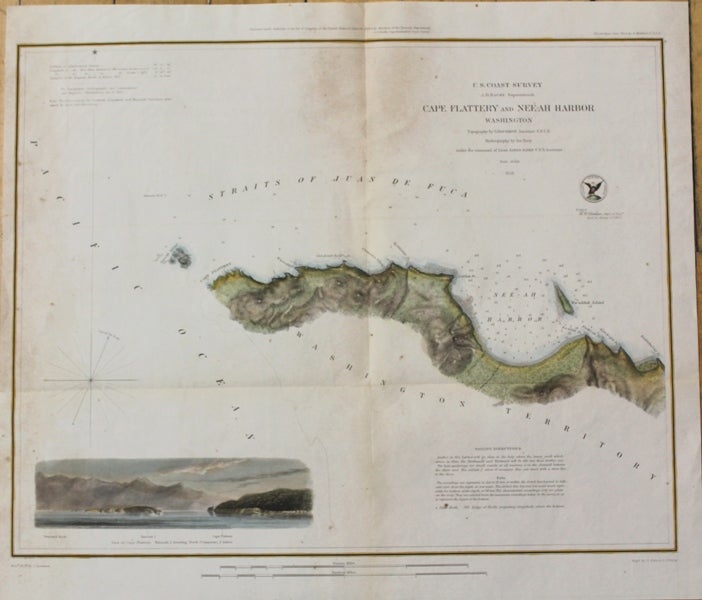
Cape Flattery and Nee-Ah Harbor Washington
Washington, D.C. Survey of the Coast of the United States, 1853. Notes: Map showing the coast of Cape Flattery, Washington and Neah Bay., Size : 340x430 (mm), 13.39x16.93 (Inches), Coloring: Hand Colored, Category: Maps United States West Washington & Oregon;. Very Good, minor browning. Item #M10598
Notes: Map showing the coast of Cape Flattery, Washington and Neah Bay., Size : 340x430 (mm), 13.39x16.93 (Inches), Coloring: Hand Colored, Category: Maps United States West Washington;.
Price: $275.00