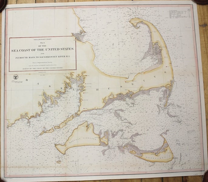
![Item #M10430 Preliminary Chart No.4 of the Sea Coast of the United States from Plymouth Mass. to Saughkonnet River R.I. [Cape Cod, Martha's Vineyard and Nantucket Island]. A D. Bache.](https://alexandremaps.cdn.bibliopolis.com/pictures/M10430.jpg?width=768&height=1000&fit=bounds&auto=webp&v=1646685229)
Preliminary Chart No.4 of the Sea Coast of the United States from Plymouth Mass. to Saughkonnet River R.I. [Cape Cod, Martha's Vineyard and Nantucket Island].
USA: Survey of the Coast of the United States, c.1857. Notes: Map Showing Cape Cod, Martha's Vineyard and Nantucket Island., Size : 545x624 (mm), 21.46x24.57 (Inches), Coloring: Hand Colored, Category: Maps United States New England (States);. Very Good, backed on acid free tissue paper for long term preservation. Item #M10430
Notes: Map Showing Cape Cod, Martha's Vineyard and Nantucket Island., Size : 545x624 (mm), 21.46x24.57 (Inches), Coloring: Hand Colored, Category: Maps United States New England Massachusetts;.
Price: $1,750.00
See all items by A D. Bache