
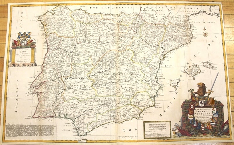
A New and Exact Map of Spain & Portugal Divided into its Kingdoms and Principalities & c., with ye Principal Roads and considerable Improvements, the whole rectifyd according to ye. Newest Observations.
London: J. & T. Bowles, c.1726. Notes: Large scale and detailed map of Portugal and Spain with a large and decorative cartouche. , Size : 625x991 (mm), 24.61x39.02 (Inches), Coloring: Original Outline Coloring refreshed, Category: Maps Europe Portugal; Maps Europe Spain;. Very Good, backed on acid free tissue paper for long term preservation, two sheets joined, folds professionally repaired. Item #M10152
Notes: Large scale and detailed map of Portugal and Spain with a large and decorative cartouche. , Size : 625x991 (mm), 24.61x39.02 (Inches), Coloring: Original Outline Coloring refreshed, Category: Maps Europe Portugal; Maps Europe Spain;.
Price: $1,250.00
See all items by Hermann Moll