
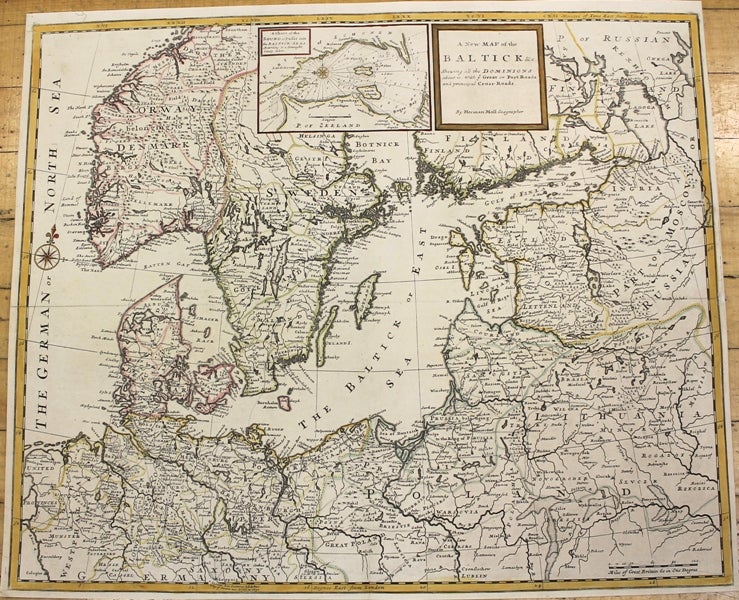
A New Map of the Baltick & c. Shewing all the Dominions about it. With ye Great or Post Roads and principal Cross-Roads.
London: J. & T. Bowles, c.1726. Notes: Detailed map of the Northern Europe and Baltic region., Size : 524x632 (mm), 20.63x24.88 (Inches), Coloring: Original Outline Coloring refreshed, Category: Maps Europe Scandinavia; Maps Europe Poland, Lithuania; Maps Europe Germany; Maps Europe Estonia, Latvia;. Very Good, backed on acid free tissue paper for long term preservation. Item #M10149
Notes: Detailed map of the Northern Europe and Baltic region., Size : 524x632 (mm), 20.63x24.88 (Inches), Coloring: Original Outline Coloring refreshed, Category: Maps Europe Scandinavia; Maps Europe Poland, Lithuania; Maps Europe Germany; Maps Europe Estonia, Latvia;.
Price: $950.00