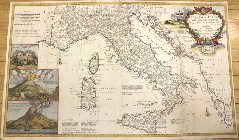
A New Map of Italy Distinguishing all the Sovereignties in it, whether States, Kingdoms, Dutchies, Principalities, Republicks & c.
London: J. & T. Bowles, c.1726. Notes: Large scale & detailed two sheet map of Italy, Sicily, Corsica and Sardinia, with large and decorative cartouche. It has inset views of a Cataract of Air on Mount Aeolius, Mt. Vesuvius and Mt. Aetna., Size : 610x1020 (mm), 24.02x40.16 (Inches), Coloring: Original Outline Coloring refreshed, Category: Maps Europe Italy; Maps Mediterranean Islands;. Very Good, backed on acid free tissue paper for long term preservation, two sheets joined. some skillful restoration at folds. Item #M10145
Notes: Large scale & detailed two sheet map of Italy, Sicily, Corsica and Sardinia, with large and decorative cartouche. It has inset views of a Cataract of Air on Mount Aeolius, Mt. Vesuvius and Mt. Aetna., Size : 610x1020 (mm), 24.02x40.16 (Inches), Coloring: Original Outline Coloring refreshed, Category: Maps Europe Italy; Maps Mediterranean Islands;.
Price: $2,500.00