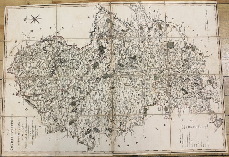
The County of Stafford, from the Improved Map in Six Sheets.
London: W. Faden, 1798. Notes: Staffordshire is a landlocked county in the West Midlands of England., Size : 729x500 (mm), 28.70x19.69 (Inches), Coloring: Original Outline Coloring, Category: Maps Folding Maps; Maps Europe United Kingdom England Counties;. Very Good, Folded map on original linen. Item #M10139
Notes: Staffordshire is a landlocked county in the West Midlands of England., Size : 729x500 (mm), 28.70x19.69 (Inches), Coloring: Original Outline Coloring, Category: Maps Folding Maps; Maps Europe United Kingdom England Counties;.
Price: $375.00