
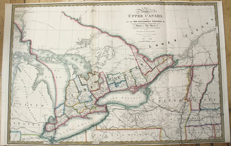
A Map of the Province of Upper Canada, describing All the New Settlements, Townships, & c. With the Countries Adjacent from Quebec to Lake Huron.
London: James Wyld, c.1842. Notes: An important and early map of Upper Canada with districts and counties shown. Map is compiled and corrected from the latest surveys in the Surveyor General's Office. It focuses on the Great Lakes, extending from Lake Superior and Lake Michigan in the West to Quebec City and New Hampshire to the East. , Size : 572x866 (mm), 22.52x34.09 (Inches), Coloring: Original Hand Coloring, Category: Maps Canada Ontario; Maps North America Great Lakes;. Very Good, Item #M10030
Notes: An important and early map of Upper Canada with districts and counties shown. Map is compiled and corrected from the latest surveys in the Surveyor General's Office. It focuses on the Great Lakes, extending from Lake Superior and Lake Michigan in the West to Quebec City and New Hampshire to the East. , Size : 572x866 (mm), 22.52x34.09 (Inches), Coloring: Original Hand Coloring, Category: Maps Canada Ontario; Maps North America Great Lakes;.
Price: $1,500.00