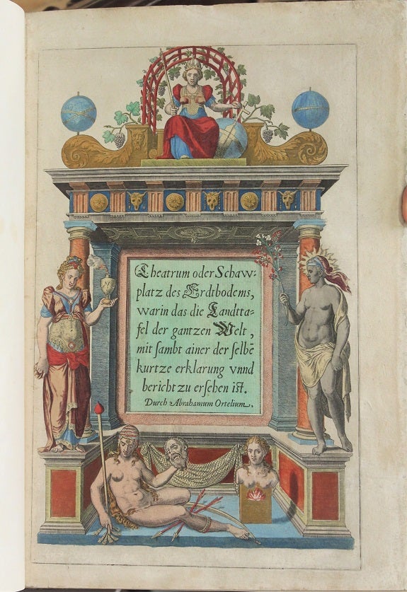
Theatrum oder Schawplatz des Erdbodems, warin das die Landttafell der gantzen welt, mitt sambt ainer der selben kurtze erklarung zu ersehn ist.
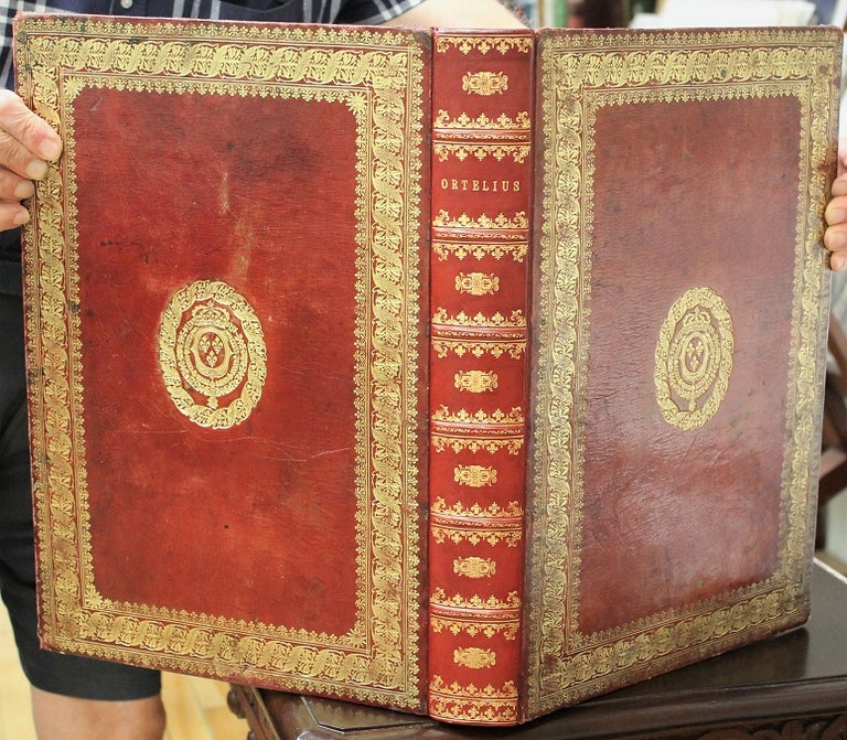
(Colophon: Antwerp: Gielis von Diest, 1572-[1573]) Durch Abrahamum Ortelium. c. 1572, [ & 1570 -1595]. Binding: Expertly rebacked in style; saving the armorial, seventeenth century, heavily gilt panelled, full red calf, with Louis xiv’s fleur-de-lis bookplates on upper and lower covers; spine raised with six (6) bands, gilt ornamented compartments and gilt lettered title on two; inner gilt dentelles. , Notes: [The 1572 German special edition plus other early maps].First very rare, German 1572 edition in contemporary colour [bound with] maps from editions up to 1595.
1572 Atlas with text in German and captions in Latin; extra plates in Latin, one in Spanish.
[A5v] Ortelius, publ.,
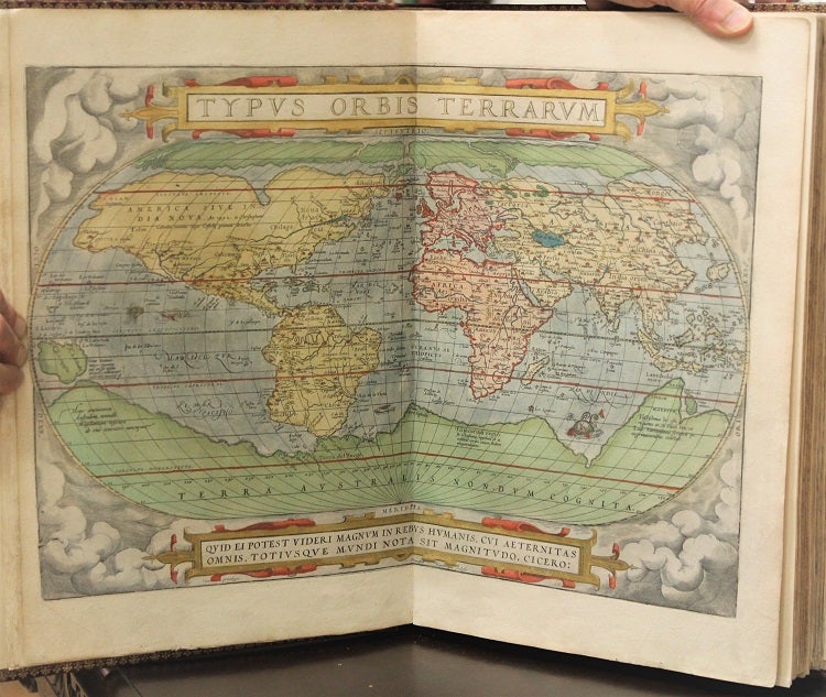
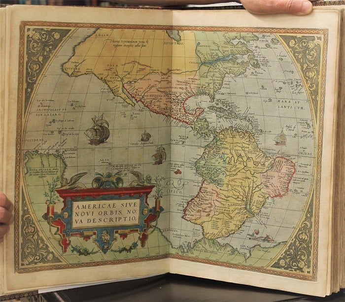
“Abraham Ortelius or Ortels or Orthellius or Wortels (1527–1598) was a … cartographer, geographer, and cosmographer, conventionally recognized as the creator of the first modern atlas, the Theatrum Orbis Terrarum…. Along with Gemma Frisius and Gerardus Mercator, Ortelius is generally considered one of the founders of the Netherlandish school of cartography and geography. He was also one of the most notable figures of the school in its golden age (approximately 1570s–1670s). The publication of his atlas in 1570 is often considered as the official beginning of the Golden Age of Netherlandish cartography. … On 20 May 1570, Gilles Coppens de Diest at Antwerp issued Ortelius's Theatrum Orbis Terrarum, the "first modern atlas" (of 53 maps)…. Three Latin editions of this (besides a Dutch, a French, and a German edition) appeared before the end of 1572. …”
Tooley states: "The publication of this atlas marked an epoch in the history of cartography. It was the first uniformly sized, systematic collection of maps of the countries of the world based only on contemporary knowledge".
“The present work is the first German edition, of the Theatrum with the German title “Theatrum oder Schawplatz des Erdtbodems, …” The plates are identical; however, the Index/ Register is reduced/ absent as explained at A5v of the German edition or Ortelius’ to the Reader or “Abraham Ortelius// Zum guetwilligen Leser.”
Shirley states: “From the first atlas in 1570 with 53 map sheets, the work grew in size so that the final edition in 1612 contained over 160 items. Initially, new maps were issued through a series of Additamenta between 1573 and 1597; in addition, a classical addendum, called the Parergon was produced from 1579 onwards.”
"Shape and contents set the standards for later atlases, when the centre of the map-trade moved from Antwerp to Amsterdam. The characteristic feature of the Theatrum is, that it consists of two elements, forming part of a unitary whole: text and maps. This concept for a 'Theatre of the world' was followed through the 17th century. Before Ortelius no one had done this" (Koeman).
Koeman (1961) mentions [on p.138/ under 49.1] the 1572 German text edition following its 1570 Latin ‘Theatrum orbis terrarum’.
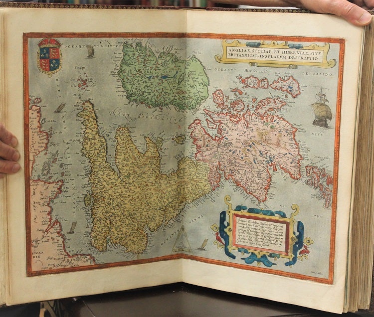
, Size: Folio (414x285mm), Illustration: Illustrated allegorical title; ornamental woodcut initials at openings (of poetry, dedication, explanation of the allegorical title and the “to the Reader”) as well as each of the 53 openings of explanatory texts preceding each plate; head and endpieces; all fifty-three (53) double page plates , reflecting the same plates first published in the 1570 Latin edition; and various literature mention that only the first German edition is similar to First Latin edition. moreover, the second edition had extra plates. the twenty (20) further double page plates representing twenty-eight (28) early maps [this includes small insert maps] dating up to 1595, both in contemporary hand colour and uncoloured.
, References: Lilly Library, Indiana University, Bloomington, The Bernando Mendel Collection, (1964): p.42; Koeman, vol.III: pp.25-33; Shirley I: p.771, Pages: Ll: Bl., A1-6 with title and texts of poetry, dedication, explanation of allegory in title, and to the reader; [ill 53 DP plates]; [ill 20 interspersed DP plates], bl., Category: Book Europe Germany; Book Atlas & Cartography;. occasional minor damp staining, map of Morocco rebacked; rare oxidization spots otherwise a very good example. Item #B6632
Price: $95,000.00