THE // WEST - INDIA ATLAS: // OR, // A Compendious Description // OF THE // WEST-INDIES: // ILLUSTRATED WITH // FORTY CORRECT CHARTS AND MAPS, // TAKEN FROM ACTUAL SURVEYS.
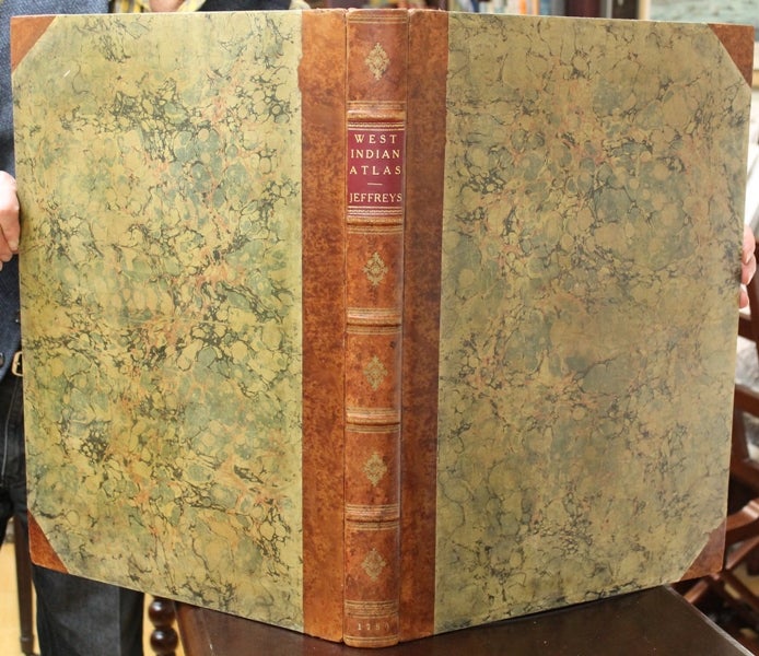
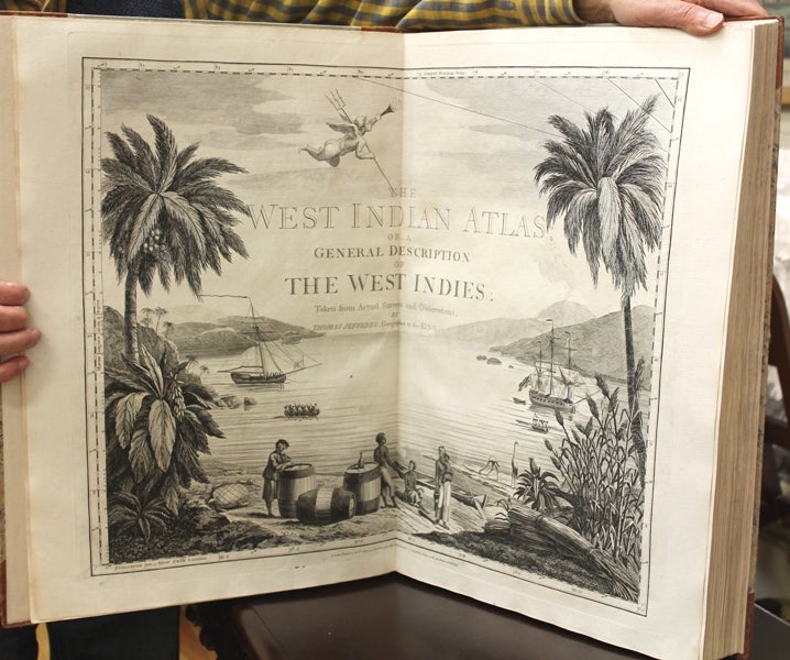
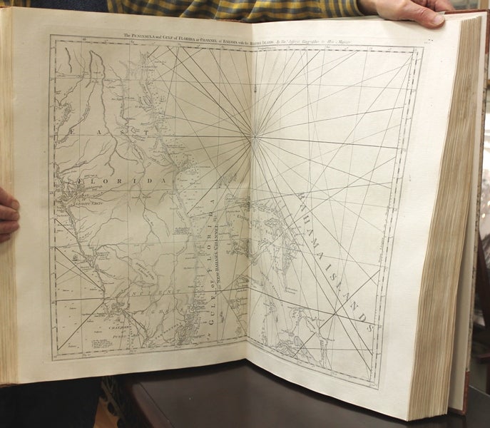
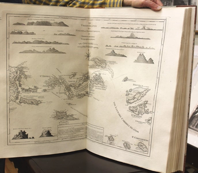
London: Robert Sayer and John Bennett. c. 1780-82 [six plates are dated 1781 or 1782]. Edition: Second or 1780 edition after the first of 1775. , Binding: Contemporary marbled boards, rebacked expertly; spine with five raised bands; gilt lettered title on red morocco label on two and compartments with central gilt ornament; dated. Endpapers renewed. Edges speckled., Notes: The maps include the individual West Indies islands, as well as the coasts of Louisiana, Florida, Texas and Mexico. The general index chart of the 'West Indies is followed by 16 detailed sea charts that could be joined to form a single general chart of the continental America and the different islands of the Caribbean. Thomas Jefferys was a leading English cartographer during the 18th century. Some of his most well-known work was a series of maps of different places in the Americas. He was named Geographer to the Prince of Wales and after that, Geographer to the King. With such power behind him he had access to many of the most accurate surveys conducted in America. , Size: Folio (541mm x 383mm) , Illustration: Illustrated with double-page engraved frontispiece title depicting a West - Indian scene along with the title commencing: “The West India Atlas” dated 20 February, 1775; three vignettes as large head- and tail pieces; decorative initials. Forty (40) sea charts – some with inserts and coastal profiles; three are single plates, the majority double - paged., References: Phillips, Atlases 2699; Sabin 35970; Shirley M. Jef-4e , Pages: Ll: Bl., double-page illustrated frontis title, A-P [with printed title, dedication, introduction, text and index]; 40 sea charts, bl. , Category: Book Atlas & Cartography. A fine example of this atlas. Maps and texts are clean and crisp. Item #B6289
Edition: Second or 1780 edition after the first of 1775. , Binding: Contemporary marbled boards, rebacked expertly; spine with five raised bands; gilt lettered title on red morocco label on two and compartments with central gilt ornament; dated. Endpapers renewed. Edges speckled., Notes: The maps include the individual West Indies islands, as well as the coasts of Louisiana, Florida, Texas and Mexico. The general index chart of the 'West Indies is followed by 16 detailed sea charts that could be joined to form a single general chart of the continental America and the different islands of the Caribbean. Thomas Jefferys was a leading English cartographer during the 18th century. Some of his most well-known work was a series of maps of different places in the Americas. He was named Geographer to the Prince of Wales and after that, Geographer to the King. With such power behind him he had access to many of the most accurate surveys conducted in America. , Size: Folio (541mm x 383mm) , Illustration: Illustrated with double-page engraved frontispiece title depicting a West - Indian scene along with the title commencing: “The West India Atlas” dated 20 February, 1775; three vignettes as large head- and tail pieces; decorative initials. Forty (40) sea charts – some with inserts and coastal profiles; three are single plates, the majority double - paged., References: Phillips, Atlases 2699; Sabin 35970; Shirley M. Jef-4e , Pages: Ll: Bl., double-page illustrated frontis title, A-P [with printed title, dedication, introduction, text and index]; 40 sea charts, bl. , Category: Book Atlas & Cartography.
Price: $45,000.00