![Item #B6001 NARRATIVE OF A JOURNEY TO THE SHORES OF THE POLAR SEA, IN THE YEARS 1819, 20, 21, AND 22.WITH AN APPENDIX ON VARIOUS SUBJECTS RELATING TO SCIENCE AND NATURAL HISTORY. [with:] NARRATIVE OF A SECOND EXPEDITION TO THE SHORES OF THE POLAR SEA, IN THE YEARS 1825, 1826, AND 1827.INCLUDING AN ACCOUNT OF THE PROGRESS OF A DETACHMENT TO THE EASTWARD, BY JOHN RICHARDSON. John FRANKLIN, F. R S., Captain R. N.](https://alexandremaps.cdn.bibliopolis.com/pictures/B6001.jpg?width=768&height=1000&fit=bounds&auto=webp&v=1646684977)
![NARRATIVE OF A JOURNEY TO THE SHORES OF THE POLAR SEA, IN THE YEARS 1819, 20, 21, AND 22.WITH AN APPENDIX ON VARIOUS SUBJECTS RELATING TO SCIENCE AND NATURAL HISTORY. [with:] NARRATIVE OF A SECOND EXPEDITION TO THE SHORES OF THE POLAR SEA, IN THE YEARS 1825, 1826, AND 1827.INCLUDING AN ACCOUNT OF THE PROGRESS OF A DETACHMENT TO THE EASTWARD, BY JOHN RICHARDSON.](https://alexandremaps.cdn.bibliopolis.com/pictures/B6001_2.jpg?auto=webp&v=1646684977)
![NARRATIVE OF A JOURNEY TO THE SHORES OF THE POLAR SEA, IN THE YEARS 1819, 20, 21, AND 22.WITH AN APPENDIX ON VARIOUS SUBJECTS RELATING TO SCIENCE AND NATURAL HISTORY. [with:] NARRATIVE OF A SECOND EXPEDITION TO THE SHORES OF THE POLAR SEA, IN THE YEARS 1825, 1826, AND 1827.INCLUDING AN ACCOUNT OF THE PROGRESS OF A DETACHMENT TO THE EASTWARD, BY JOHN RICHARDSON.](https://alexandremaps.cdn.bibliopolis.com/pictures/B6001_3.jpg?auto=webp&v=1646684978)
NARRATIVE OF A JOURNEY TO THE SHORES OF THE POLAR SEA, IN THE YEARS 1819, 20, 21, AND 22.WITH AN APPENDIX ON VARIOUS SUBJECTS RELATING TO SCIENCE AND NATURAL HISTORY. [with:] NARRATIVE OF A SECOND EXPEDITION TO THE SHORES OF THE POLAR SEA, IN THE YEARS 1825, 1826, AND 1827.INCLUDING AN ACCOUNT OF THE PROGRESS OF A DETACHMENT TO THE EASTWARD, BY JOHN RICHARDSON.
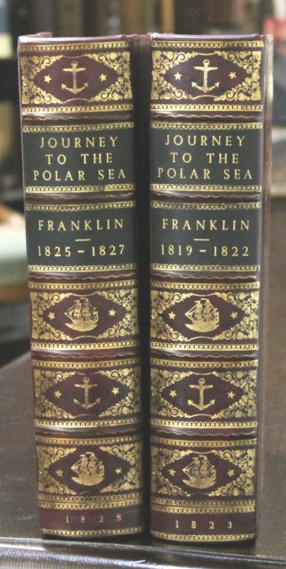
London: John Murray. c. 1823, 1828. Edition: First editions, first issues, Binding: Contemporary marbled boards rebacked expertly, spine with 5 raised bands, gilt ornamented compartments and gilt title on two. Front and lower edges uncut.
, Notes: In 1819, Franklin was chosen to lead an expedition overland from Hudson Bay to chart the north coast of Canada eastwards from the mouth of the Coppermine River.[10] On his 1819 expedition, Franklin fell into the Hayes River at Robinson Falls and was rescued by a member of his expedition about 90 metres (98 yd) downstream. Between 1819 and 1822, he lost 11 of the 20 men in his party. Most died of starvation, but there were also at least one murder and suggestions of cannibalism. The survivors were forced to eat lichen and even attempted to eat their own leather boots. This gained Franklin the nickname of "the man who ate his boots".
In 1825, he left for his second Canadian and third Arctic expedition. The goal this time was the mouth of the Mackenzie River from which he would follow the coast westward and possibly meet Frederick William Beechey who would try to sail northeast from the Bering Strait. With him was John Richardson who would follow the coast east from the Mackenzie to the mouth of the Coppermine River. At the same time, William Edward Parry would try to sail west from the Atlantic. (Beechey reached Point Barrow and Parry became frozen in 900 miles east. At this time, the only known points on the north coast were a hundred or so miles east from the Bering Strait, the mouth of the Mackenzie, Franklin's stretch east of the Coppermine, and a bit of the Gulf of Boothia which had been seen briefly from land.) Supplies were better organized this time, in part because they were managed by Peter Warren Dease of the Hudson's Bay Company. After reaching the Great Slave Lake using the standard HBC route, Franklin took a reconnaissance trip 1,000 miles down the Mackenzie and on 16 August 1825, became the second European to reach its mouth. He erected a flagpole with buried letters for Parry. He returned to winter at Fort Franklin on the Great Bear Lake. The following summer he went downriver and found the ocean frozen. He worked his way west for several hundred miles and gave up on 16 August 1826 at Return Reef when he was about 150 miles east of Beechey's Point Barrow. Reaching safety at Fort Franklin on 21 September, he left Fort Franklin on 20 February 1827 and spent the rest of the winter and spring at Fort Chipewyan, Alberta. He reached Liverpool on the first of September 1827. Richardson's eastward journey was more successful.
Rear-Admiral Sir John Franklin (1786-1847) was a British Royal Navy officer and explorer of the Arctic. Franklin also served as Lieutenant-Governor of Van Diemen’s Land (now Tasmania) from 1837 to 1843. He disappeared on his last expedition, attempting to chart and navigate a section of the Northwest Passage in the Canadian Arctic. The icebound ships were abandoned and the entire crew perished from starvation, hypothermia, tuberculosis, lead poisoning and scurvy.
The work included extensive appendix on science and natural history, Wagner Camp: “of interest not only as a document of human courage and endurance, but alas for its depiction of the Indians - Cree, Dog - Rib, and Chipewyan - on whom the survival of the expedition at last depended.”
, Size: Quarto (283 x 225mm). , Illustration: Voyage (1): Illustrated with 30 hand-coloured plates, including one called for on page 254 but bound as frontispiece; some, esp. portraits or illustrations of persons, in contemporary colour; plus 4 folding maps; - all as listed on table contents. P. Frontispiece entitled “Keskarrah a Copper Indian Guid …” , title, printer’s note, dedication to the Earl of Bathurst, blank, half-title , blank, contents (3), list of plates, introduction xi-xvi, errata slip, 1-494, appendix 495-768, advertising (8); with 29 plates and 4 maps.
Voyage (2): Illustrated with 30 engraved plates and 6 large folding maps; p. ?, frontispiece entitled “the Esquimaux Pillaging the Boats”, advertisement, title, dedication to the Earl of Bathurst, blank, contents (2), appendix, list of plates, introduction (ix-xxiv), official instructions (4), 1- 320, appendix (i-clvii), errata, blank.
, Volume: 2 volumes., References: Abbey Travel 635 (1st title); Sabin 25624; Hill Collection 111; field 560; TPL 1248; Lande 1181; Peel 80; Wagner Camp 23:1, Category: Book Canada; Book Arctic & Antarctic; Book Voyages General;. A handsome copy in very good condition, text and plates are clean and crisp, very slight occasional faint browning of only few pages. Item #B6001
Edition: First editions, first issues, Binding: Contemporary marbled boards rebacked expertly, spine with 5 raised bands, gilt ornamented compartments and gilt title on two. Front and lower edges uncut.
, Notes: In 1819, Franklin was chosen to lead an expedition overland from Hudson Bay to chart the north coast of Canada eastwards from the mouth of the Coppermine River.[10] On his 1819 expedition, Franklin fell into the Hayes River at Robinson Falls and was rescued by a member of his expedition about 90 metres (98 yd) downstream. Between 1819 and 1822, he lost 11 of the 20 men in his party. Most died of starvation, but there were also at least one murder and suggestions of cannibalism. The survivors were forced to eat lichen and even attempted to eat their own leather boots. This gained Franklin the nickname of "the man who ate his boots".
In 1825, he left for his second Canadian and third Arctic expedition. The goal this time was the mouth of the Mackenzie River from which he would follow the coast westward and possibly meet Frederick William Beechey who would try to sail northeast from the Bering Strait. With him was John Richardson who would follow the coast east from the Mackenzie to the mouth of the Coppermine River. At the same time, William Edward Parry would try to sail west from the Atlantic. (Beechey reached Point Barrow and Parry became frozen in 900 miles east. At this time, the only known points on the north coast were a hundred or so miles east from the Bering Strait, the mouth of the Mackenzie, Franklin's stretch east of the Coppermine, and a bit of the Gulf of Boothia which had been seen briefly from land.) Supplies were better organized this time, in part because they were managed by Peter Warren Dease of the Hudson's Bay Company. After reaching the Great Slave Lake using the standard HBC route, Franklin took a reconnaissance trip 1,000 miles down the Mackenzie and on 16 August 1825, became the second European to reach its mouth. He erected a flagpole with buried letters for Parry. He returned to winter at Fort Franklin on the Great Bear Lake. The following summer he went downriver and found the ocean frozen. He worked his way west for several hundred miles and gave up on 16 August 1826 at Return Reef when he was about 150 miles east of Beechey's Point Barrow. Reaching safety at Fort Franklin on 21 September, he left Fort Franklin on 20 February 1827 and spent the rest of the winter and spring at Fort Chipewyan, Alberta. He reached Liverpool on the first of September 1827. Richardson's eastward journey was more successful.
Rear-Admiral Sir John Franklin (1786-1847) was a British Royal Navy officer and explorer of the Arctic. Franklin also served as Lieutenant-Governor of Van Diemen’s Land (now Tasmania) from 1837 to 1843. He disappeared on his last expedition, attempting to chart and navigate a section of the Northwest Passage in the Canadian Arctic. The icebound ships were abandoned and the entire crew perished from starvation, hypothermia, tuberculosis, lead poisoning and scurvy.
The work included extensive appendix on science and natural history, Wagner Camp: “of interest not only as a document of human courage and endurance, but alas for its depiction of the Indians - Cree, Dog - Rib, and Chipewyan - on whom the survival of the expedition at last depended.”
, Size: Quarto (283 x 225mm). , Illustration: Voyage (1): Illustrated with 30 hand-coloured plates, including one called for on page 254 but bound as frontispiece; some, esp. portraits or illustrations of persons, in contemporary colour; plus 4 folding maps; - all as listed on table contents. P. Frontispiece entitled “Keskarrah a Copper Indian Guid …” , title, printer’s note, dedication to the Earl of Bathurst, blank, half-title , blank, contents (3), list of plates, introduction xi-xvi, errata slip, 1-494, appendix 495-768, advertising (8); with 29 plates and 4 maps.
Voyage (2): Illustrated with 30 engraved plates and 6 large folding maps; p. ?, frontispiece entitled “the Esquimaux Pillaging the Boats”, advertisement, title, dedication to the Earl of Bathurst, blank, contents (2), appendix, list of plates, introduction (ix-xxiv), official instructions (4), 1- 320, appendix (i-clvii), errata, blank.
, Volume: 2 volumes., References: Abbey Travel 635 (1st title); Sabin 25624; Hill Collection 111; field 560; TPL 1248; Lande 1181; Peel 80; Wagner Camp 23:1, Category: Book Canada; Book Arctic & Antarctic; Book Voyages General;.
Price: $8,500.00