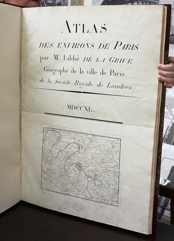
ATLAS DES ENVIRONS PARIS par Mr. l’abbe De La Grive Geographe de la ville de Paris. De la Societe Royal de Londres
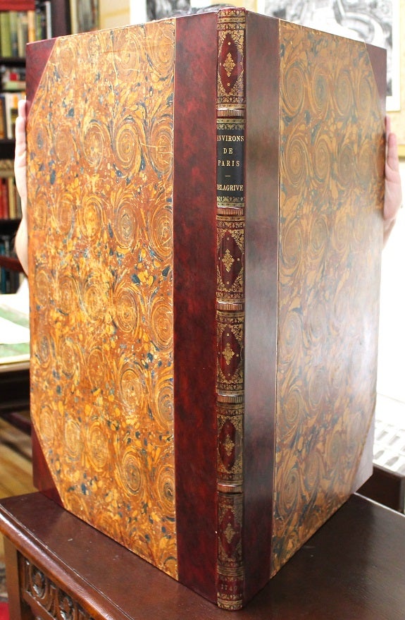
Paris: De Charbonier. C. 1740. Binding: Contemporary marbled paper boards with matching free end papers, expertly rebacked in gilt fillet bordered brown half calf; spine with five raised bands; gilt lettered title on black morocco label on two; remaining compartments in gilt borders, corners and central ornaments.
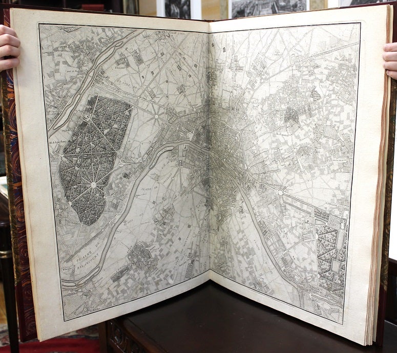
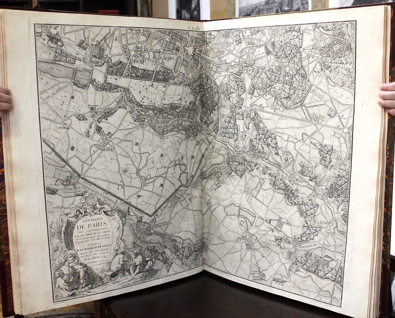
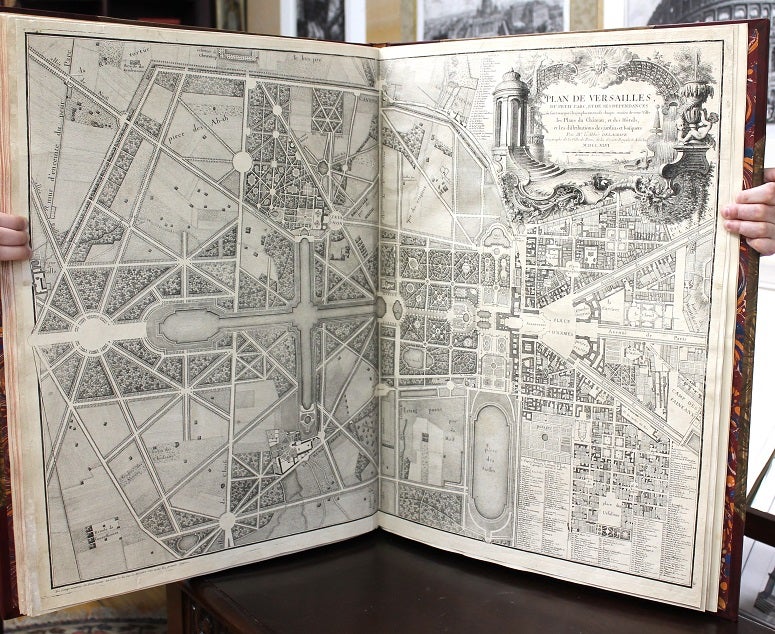
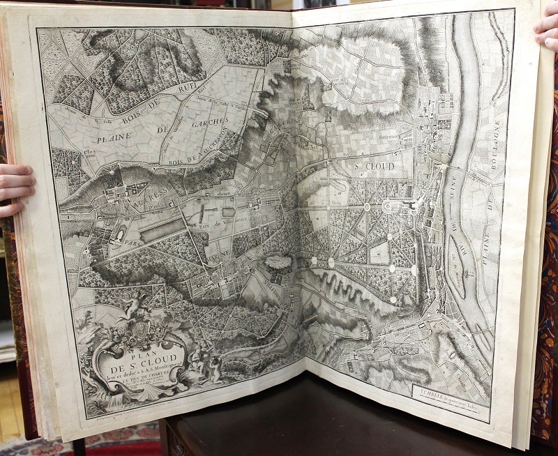
, Notes: Jean Delagrive (1689 - 1757), professor of philosophy at the university in Krakow; is remembered for his work as engraver / topographer. He was a priest but abandoned the church to follow geography, drawing, engraving and triangulation. His plans of Paris and environs, i.e. Versailles and St. Cloud, earned him the position of geographer of Paris. It has been noted that the Champs - Élysées was first mentioned on one of his maps. Delagrive was passionate about geometry and published a manual, ‘de trigonometrie spherique’ on ‘spherical trigonometry’ in 1754. He was a member of the royal society of London., Size: Large Folio (640mm x 940m, Illustration: A finely illustrated atlas of the city and surroundings of Paris including the two celebrated maps of Versailles and St. Cloud, with rivers, streams, roads, paths, villages, abbeys and castles, depicted. Information on the use of land, its agriculture, forests, parks & water supply is also provided.
Extra illustrated with 11 double page engraved maps, and one-half page map below the title.
, References: Tooley’s dictionary of mapmakers, page 350, Pages: P. Title with engraved maps., Category: Book Europe France; Book Atlas & Cartography. A scarce atlas in very good condition, maps are clean and crisp, minor browning on the verso of some maps.
. Item #B5983
Binding: Contemporary marbled paper boards with matching free end papers, expertly rebacked in gilt fillet bordered brown half calf; spine with five raised bands; gilt lettered title on black morocco label on two; remaining compartments in gilt borders, corners and central ornaments.
, Notes: Jean Delagrive (1689 - 1757), professor of philosophy at the university in Krakow; is remembered for his work as engraver / topographer. He was a priest but abandoned the church to follow geography, drawing, engraving and triangulation. His plans of Paris and environs, i.e. Versailles and St. Cloud, earned him the position of geographer of Paris. It has been noted that the Champs - Élysées was first mentioned on one of his maps. Delagrive was passionate about geometry and published a manual, ‘de trigonometrie spherique’ on ‘spherical trigonometry’ in 1754. He was a member of the royal society of London., Size: Large Folio (640mm x 940m, Illustration: A finely illustrated atlas of the city and surroundings of Paris with rivers, streams, roads, paths, villages, abbeys and castles, depicted. Information on the use of land, its agriculture, forests, parks & water supply is also provided.
Illustrated with 9 double page engraved maps, and one-half page map below the title.
, References: Tooley’s dictionary of mapmakers, page 350, Pages: P. Title with engraved maps., Category: Book Europe France; Book Atlas & Cartography.
Price: $12,750.00