
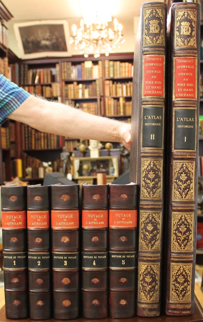
Voyage de la Corvette L’Astrolabe execute pendant les Annees 1826-1827-1828-1829 (Atlas Historique with all five text volumes)
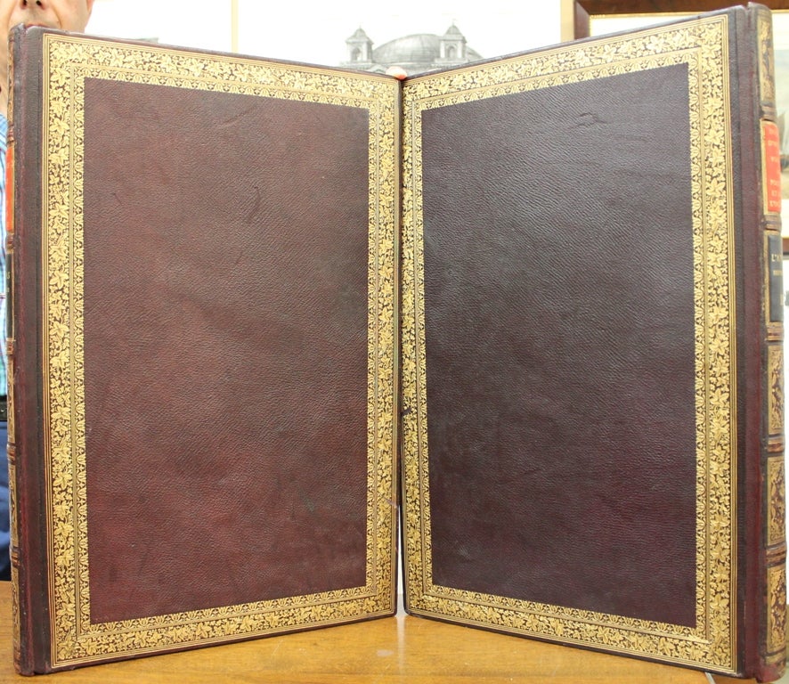
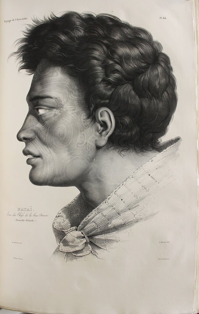
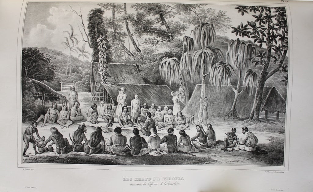
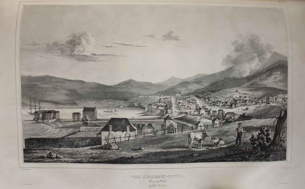
Paris: J. Tastu, c. 1830-1833. Binding: Contemporary full decorative maroon morocco, rebacked preserving original spine, with a large ornate gilt border in a floral motif on covers. Spine in six compartments of raised bands. Gilt text on morocco label on 2 and 3. Dense and ornate gilt ornamentation on 1, 4, 5, and 6. Gilt dentelles on all binding edges. Pasted and free beige endpapers. The text volumes are bound in recent quarter calf with marbled boards. Spines are in 6 compartments of raised bands. Gilt text on morocco label on 2 and 4. Gilt decoration on 1, 3, 5, and 6. All edges speckled. Pasted and free illustrated endpapers. , Notes: Text is in French. This great work is part of a larger undertaking by d’Urville which encompasses natural history and marine biology in 23 volumes. A fine and scarce work from the early 19th century that documents the French voyages of scientific discovery and political expansion in the late 18th and early 19th centuries. The Atlas Historique details the topography and shows numerous views of places and people as well as maps while other volumes deal with natural history. The expedition was helmed by Jules Dumont d'Urville and its main purpose was to ‘gain additional information about the principal groups of islands in the Pacific and to augment the mass of scientific data acquired by Louis Duperrey. The Astrolabe sailed south, around the Cape of Good Hope, and arrived at Port Jackson. Proceeding to New Zealand, its coast, especially the southern part of Cook Strait, was surveyed with great care. Tonga and parts of the Fiji Archipelago were explored, then New Britain, New Guinea, Amboina, Tasmania, Vanikoro, Guam and Java. The return home was by way of Mauritius and the Cape of Good Hope. Huge amounts of scientific materials were collected and published' (Hill p. 176). The main focus of the Atlas is the regions around New Zealand and Australia with plates showing Van Diemens Land, New Zealand, New Holland, New Guinea etc…, Size: Atlas: Large Folio (540x3, Illustration: There are several in-text vignettes in the text volumes. The Atlas (in two parts) is illustrated with 236 (of 240) plates. 47 plates are hand coloured. Most of the plates are by Louis Auguste de Sainson (the official artist of the expedition). , Volume: 5 text volumes and 2 atl, References: Hill, p. 175-176; Ferguson, no. 1341; Phillips, 201; Bagnall, 1687, Category: Book Pacific; Book Plate Books Colour;; Book Voyages General;. A fine example of this scarce work with the text volumes. Plates are clean and crisp. Text is generally clean but with occasional mild yellowing. Item #B5534
Binding: Contemporary full decorative maroon morocco, rebacked preserving original spine, with a large ornate gilt border in a floral motif on covers. Spine in six compartments of raised bands. Gilt text on morocco label on 2 and 3. Dense and ornate gilt ornamentation on 1, 4, 5, and 6. Gilt dentelles on all binding edges. Pasted and free beige endpapers. The text volumes are bound in recent quarter calf with marbled boards. Spines are in 6 compartments of raised bands. Gilt text on morocco label on 2 and 4. Gilt decoration on 1, 3, 5, and 6. All edges speckled. Pasted and free illustrated endpapers. , Notes: Text is in French. This great work is part of a larger undertaking by d’Urville which encompasses natural history and marine biology in 23 volumes. A fine and scarce work from the early 19th century that documents the French voyages of scientific discovery and political expansion in the late 18th and early 19th centuries. The Atlas Historique details the topography and shows numerous views of places and people as well as maps while other volumes deal with natural history. The expedition was helmed by Jules Dumont d'Urville and its main purpose was to ‘gain additional information about the principal groups of islands in the Pacific and to augment the mass of scientific data acquired by Louis Duperrey. The Astrolabe sailed south, around the Cape of Good Hope, and arrived at Port Jackson. Proceeding to New Zealand, its coast, especially the southern part of Cook Strait, was surveyed with great care. Tonga and parts of the Fiji Archipelago were explored, then New Britain, New Guinea, Amboina, Tasmania, Vanikoro, Guam and Java. The return home was by way of Mauritius and the Cape of Good Hope. Huge amounts of scientific materials were collected and published' (Hill p. 176). The main focus of the Atlas is the regions around New Zealand and Australia with plates showing Van Diemens Land, New Zealand, New Holland, New Guinea etc…, Size: Atlas: Large Folio (540x3, Illustration: There are several in-text vignettes in the text volumes. The Atlas (in two parts) is illustrated with 236 (of 240) plates. 47 plates are hand coloured. Most of the plates are by Louis Auguste de Sainson (the official artist of the expedition). , Volume: 5 text volumes and 2 atl, References: Hill, p. 175-176; Ferguson, no. 1341; Phillips, 201; Bagnall, 1687, Category: Book Pacific; Book Plate Books Colour;; Book Voyages General;.
Price: $40,000.00