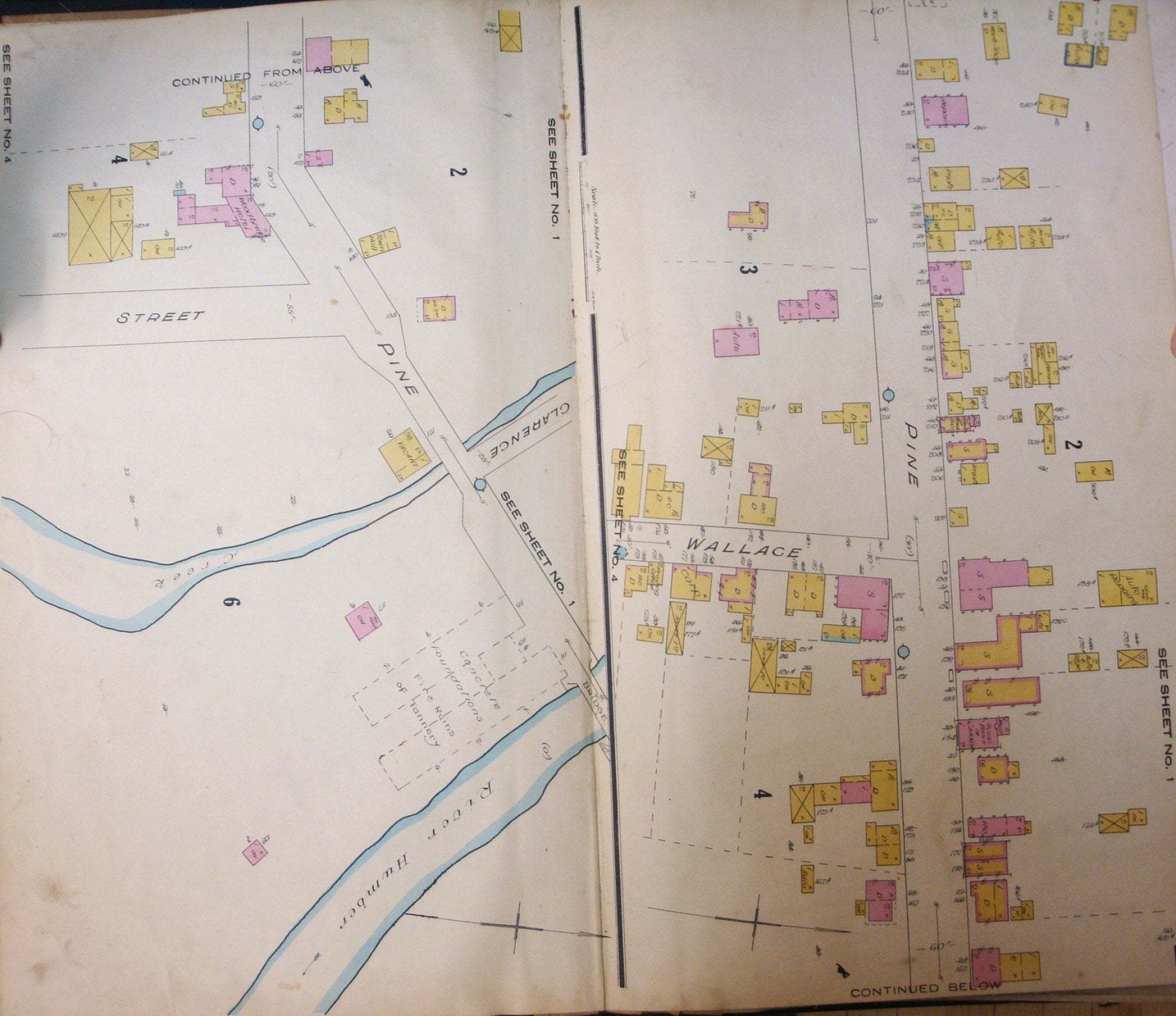
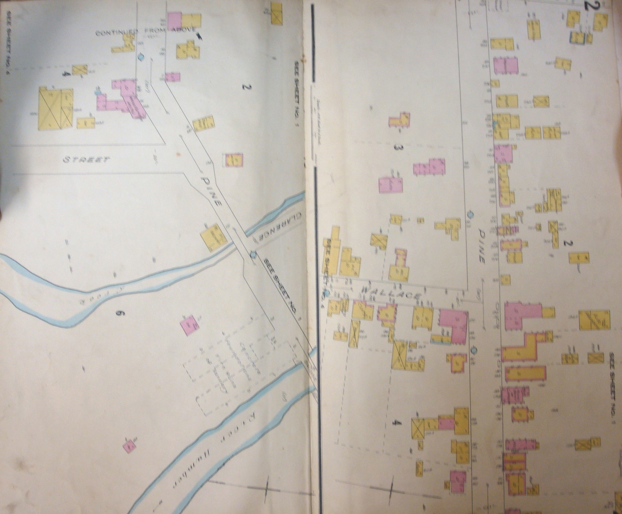
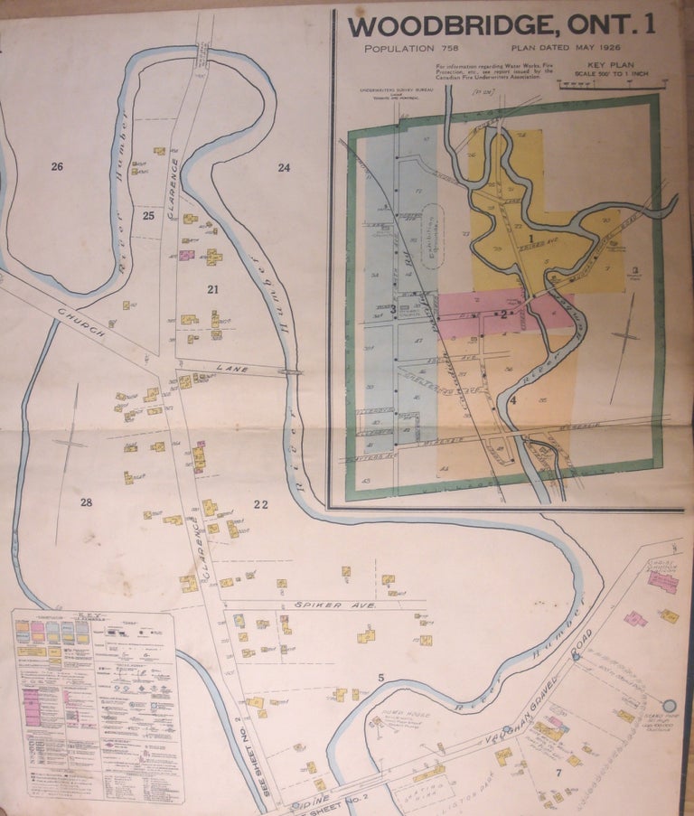
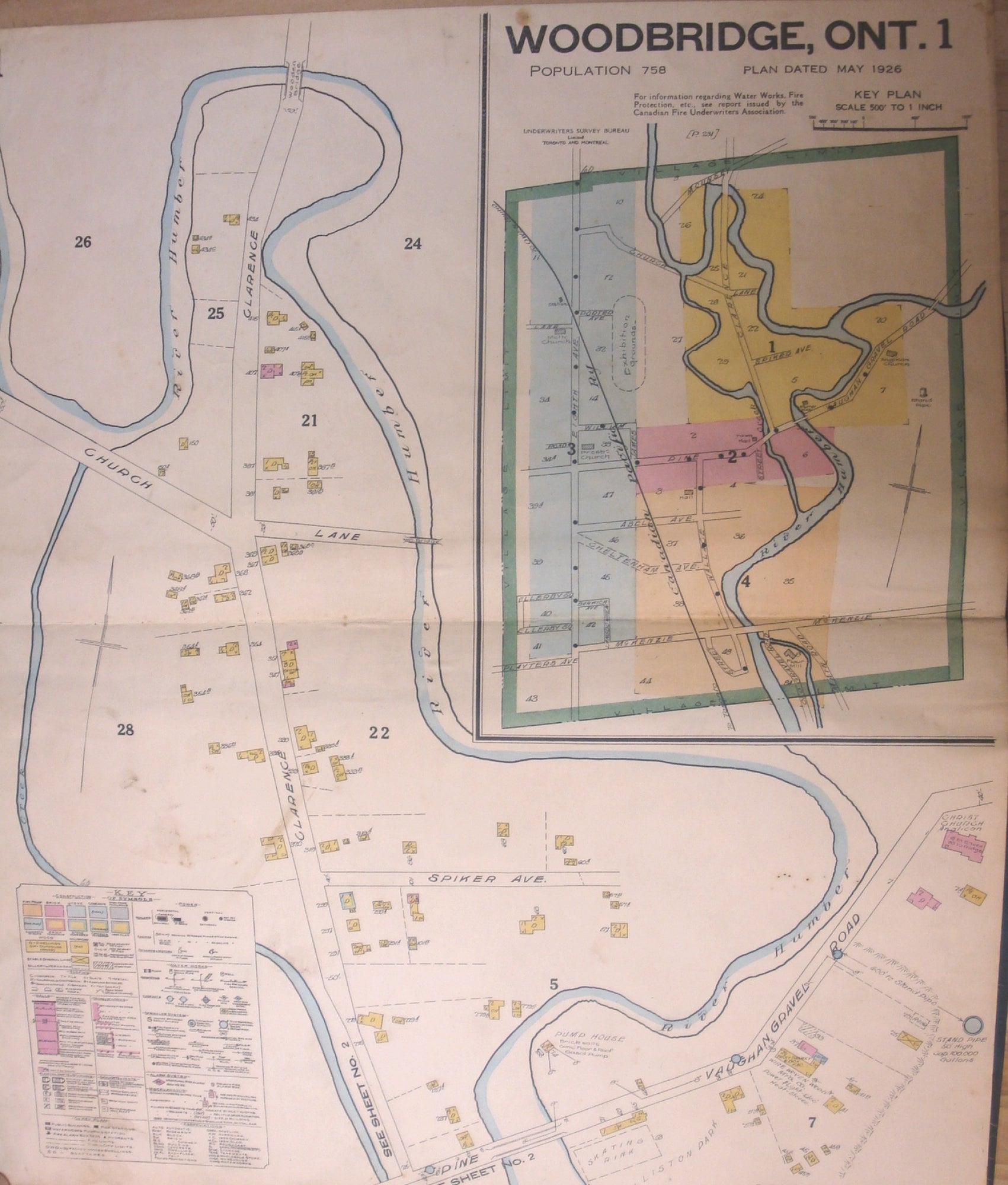
Insurance Plan of Woodbridge Ont.
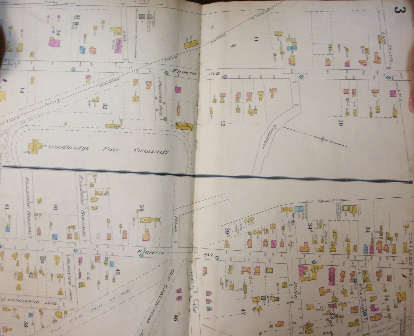
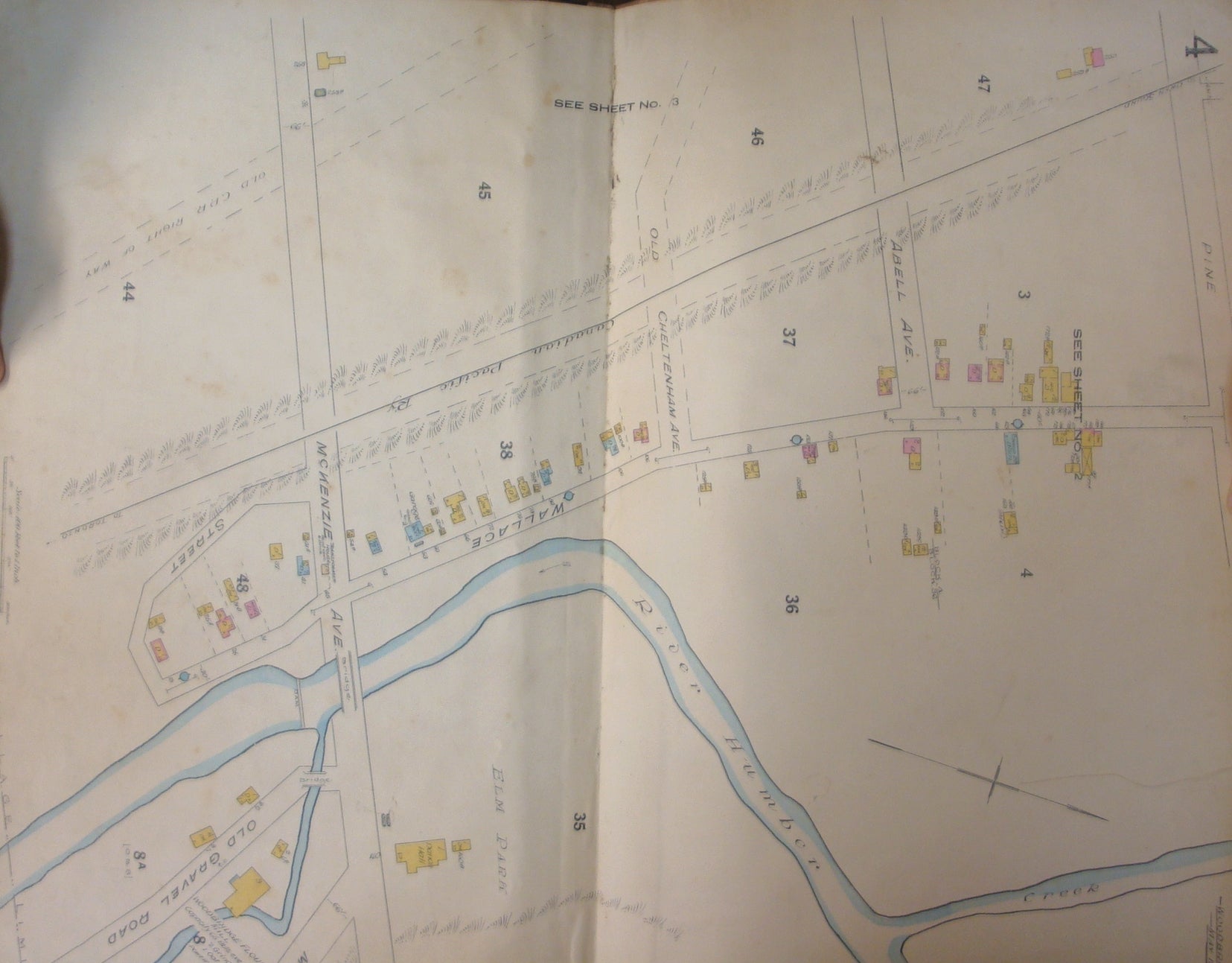
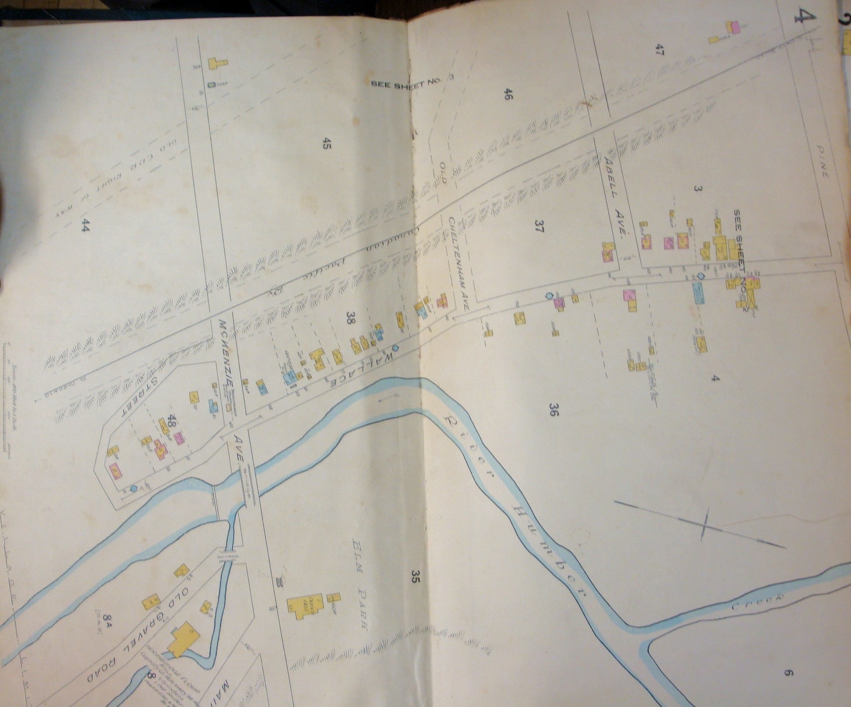
Toronto: Underwriters Survey Bureau Limited, 1926. Binding: Original cloth boards. , Notes: Very scarce atlas and insurance plan of the town of Woodbridge printed in the early 20th century by the Underwriters’ Survey Bureau Limited in fine condition.
The Canadian Fire Underwriters' Association was founded in 1883 for the purpose of standardizing fire insurance regulations. Up to the year 1918, the maps were prepared by the Chas. E. Goad map making company and was published by the Canadian Fire Underwriters Association. This agreement ended in 1918, and the Canadian Fire Underwriters' Association started their own mapmaking process and was renamed the Underwriters’ Survey Bureau Limited. At the same time they purchased the exclusive rights from the Chas. E. Goad company to revise and reprint their maps. The Goad Company continued to operate until 1930 and in 1931 the Underwriters’ Survey Bureau Limited acquired all the assets of the Chas. E. Goad Company. They continued to produce various fire insurance plans for cities and towns in Ontario, Quebec, and the Martimes.
Fire insurance plans provide detailed information about buildings and neighbourhoods. They can be used to determine when a building was built or demolished, details of building materials, position of building on lot, lot and address numbers, and lot sizes and shapes. They can show how a neighbourhood has changed over the years
The Underwriters' Survey Bureau published individual volumes from the 1920s to the 1940s, and a 1952-73 multi-volume set, covering most of Toronto but concentrating on commercial and industrial districts. The earliest plans cover only the former City of Toronto, while later ones branch out into suburban areas. Not all areas are covered in all years.
, Illustration: Illustrated with 4 color double page maps depicting various areas of Markham in full detail including mainstreets, sidestreets, lots, and also the vulnerability of various buildings prone to fire. , Category: Book Atlas & Cartography; Book Canada. Spine is worn, maps are layed down on original canvas, otherwise very good. Item #B3932
Binding: Original cloth boards. , Notes: Very scarce atlas and insurance plan of the town of Woodbridge printed in the early 20th century by the Underwriters’ Survey Bureau Limited in fine condition.
The Canadian Fire Underwriters' Association was founded in 1883 for the purpose of standardizing fire insurance regulations. Up to the year 1918, the maps were prepared by the Chas. E. Goad map making company and was published by the Canadian Fire Underwriters Association. This agreement ended in 1918, and the Canadian Fire Underwriters' Association started their own mapmaking process and was renamed the Underwriters’ Survey Bureau Limited. At the same time they purchased the exclusive rights from the Chas. E. Goad company to revise and reprint their maps. The Goad Company continued to operate until 1930 and in 1931 the Underwriters’ Survey Bureau Limited acquired all the assets of the Chas. E. Goad Company. They continued to produce various fire insurance plans for cities and towns in Ontario, Quebec, and the Martimes.
Fire insurance plans provide detailed information about buildings and neighbourhoods. They can be used to determine when a building was built or demolished, details of building materials, position of building on lot, lot and address numbers, and lot sizes and shapes. They can show how a neighbourhood has changed over the years
The Underwriters' Survey Bureau published individual volumes from the 1920s to the 1940s, and a 1952-73 multi-volume set, covering most of Toronto but concentrating on commercial and industrial districts. The earliest plans cover only the former City of Toronto, while later ones branch out into suburban areas. Not all areas are covered in all years.
, Illustration: Illustrated with 4 color double page maps depicting various areas of Markham in full detail including mainstreets, sidestreets, lots, and also the vulnerability of various buildings prone to fire. , Category: Book Atlas & Cartography; Book Canada.
Price: $1,116.07