
Tartarie
Paris: 1680. Size : 124x176 (mm), 4.875x6.875 (Inches), Coloring: Black & White, Category: ; Maps Russia. Size : 124x176 (mm), 4.875x6.875 (Inches), Coloring: Black & White, Category: ; Maps Russia.
Paris: 1680. Size : 124x176 (mm), 4.875x6.875 (Inches), Coloring: Black & White, Category: ; Maps Russia. Size : 124x176 (mm), 4.875x6.875 (Inches), Coloring: Black & White, Category: ; Maps Russia.
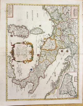
Paris: 1677. Notes: Detailed map with coats of arms of various parts of Italy and inset map of Sicily., Size : 381x496 (mm), 15.00x19.53 (Inches), Coloring: Hand Colored, Category: Maps Europe Italy; Maps Mediterranean Islands;. Notes: Detailed map with coats of arms of various parts of Italy and inset map.....
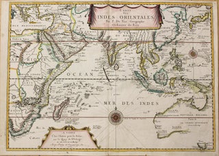
Paris: c.1665. Notes: Very rare significant and first edition map published in 1665, from Duval's atlas, Cartes de Geographie les Plus Nouvelles depicting Indian Ocean, extending from Australia and South Africa to China and Asia Minor. This is one of the earliest French maps to show the important 17th Century.....
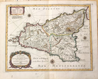
Paris: 1676. Notes: Decorative 17th century map of Sicily depicting major cities, roads and rivers., Size : 365x485 (mm), 14.37x19.09 (Inches), Coloring: Original Outline Coloring, Category: Maps Mediterranean Islands;. Notes: Decorative 17th century map of Sicily depicting major cities, roads and rivers., Size : 365x485 (mm), 14.37x19.09 (Inches), Coloring: Original.....
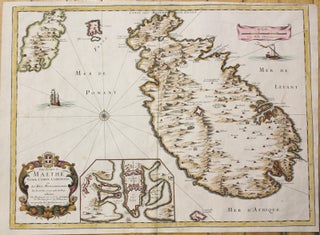
Paris: 1667. Notes: Rare map of the islands of Malta, Gozo, Comino and Cominotto. With an inset map showing Valletta., Size : 396x533 (mm), 15.59x20.98 (Inches), Coloring: Hand Colored, Category: Maps Mediterranean Islands;. Notes: Rare map of the islands of Malta, Gozo, Comino and Cominotto. With an inset map showing.....
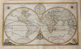
Paris: 1676. Notes: Third State of this double hemisphere map of the World by Pierre Du Val. , Size : 350x605 (mm), 13.78x23.82 (Inches), Coloring: Hand Colored, Reference: Shirley #441, Category: Maps World;. Notes: Third State of this double hemisphere map of the World by Pierre Du Val. , Size.....