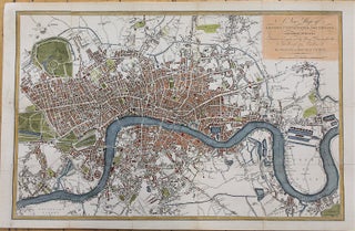
A New Map of London, Westminster, Southwark, and their Suburbs. Drawn from actual Survey, for the History of London, By Sholto & Reuben Percy.
London: T. Boys, 1823. Notes: Detailed map of London in early 19th century., Size : 246x387 (mm), 9.69x15.24 (Inches), Coloring: Hand Colored, Category: Maps City Maps; Maps Europe United Kingdom England London;.