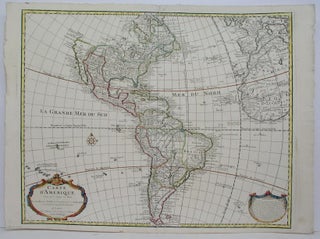
Carte D'Amerique
Paris: 1733. Size : 490x620 (mm), 19.25x24.375 (Inches), Coloring: Hand Colored in Outline. Size : 490x620 (mm), 19.25x24.375 (Inches), Coloring: Hand Colored in Outline.
Paris: 1733. Size : 490x620 (mm), 19.25x24.375 (Inches), Coloring: Hand Colored in Outline. Size : 490x620 (mm), 19.25x24.375 (Inches), Coloring: Hand Colored in Outline.
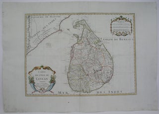
Paris: 1782. Size : 420x570 (mm), 16.5x22.375 (Inches), Coloring: Hand Colored in Outline, Category: Maps Asia Central India & Sri Lanka / Ceylon;. Size : 420x570 (mm), 16.5x22.375 (Inches), Coloring: Hand Colored in Outline, Category: ; Maps Asia Central Sri Lanka / Ceylon.
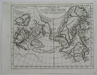
Zurich: Heidegger, 1752. Notes: "A track of Admiral Fonte apocryphal discovery of a north-west passage on a voyage in 1640, appeared on various maps of the mid 18th century, including those of Delisle and Le Rouge." (Tooley Vol II pg. 85) This map is from "Diderot's Enclyclopedie", Size : 290x370.....
Amsterdam: Pierre Mortier, 1724. Notes: Two seperat map sheets., Size : 450x585 (mm), 17.75x23 (Inches), Coloring: Original Outline Coloring, Category: ; Maps North America; Maps West Indies Whole; Maps South America Continent. Notes: Two seperat map sheets., Size : 450x585 (mm), 17.75x23 (Inches), Coloring: Original Outline Coloring, Category: ; Maps.....

Paris: 1703. Size : 490x640 (mm), 19.25x25.125 (Inches), Coloring: Hand Colored, Reference: Mojski, Piotr Maria, "Cartographia Rappersviliana Polonorum", page 152, number 102, Category: ; Maps Europe Poland, Lithuania. Size : 490x640 (mm), 19.25x25.125 (Inches), Coloring: Hand Colored, Reference: Mojski, Piotr Maria, "Cartographia Rappersviliana Polonorum", page 152, number 102, Category: ;.....
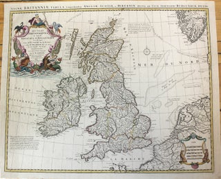
Amsterdam: Covens and Mortier, c.1730. Size : 470x575 (mm), 18.5x22.625 (Inches), Coloring: Original Outline Coloring, Category: ; Maps Europe Ireland;; Maps Europe United Kingdom. Size : 470x575 (mm), 18.5x22.625 (Inches), Coloring: Original Outline Coloring, Category: ; Maps Europe Ireland;; Maps Europe United Kingdom.
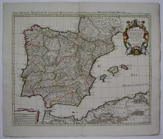
Amsterdam: 1730. Size : 500x605 (mm), 19.625x23.75 (Inches), Coloring: Hand Colored in Outline, Category: ; Maps Europe Portugal; Maps Europe Spain. Size : 500x605 (mm), 19.625x23.75 (Inches), Coloring: Hand Colored in Outline, Category: ; Maps Europe Portugal; Maps Europe Spain.
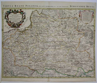
Amsterdam: Covens and Mortier, 1720. Notes: (Stolen), Size : 485x605 (mm), 19.125x23.75 (Inches), Coloring: Original Outline Coloring, Category: ; Maps Europe Poland, Lithuania. Notes: (Stolen), Size : 485x605 (mm), 19.125x23.75 (Inches), Coloring: Original Outline Coloring, Category: ; Maps Europe Poland, Lithuania.
Augsburg: G.F. Lotter, 1762. Size : 487x600 (mm), 19.17x23.62 (Inches), Coloring: Original Outline Coloring, Category: Maps Europe Hungary;Maps Europe Romania;Maps Europe Ukraine;. Size : 487x600 (mm), 19.17x23.62 (Inches), Coloring: Original Outline Coloring, Category: Maps Europe Hungary;Maps Europe Romania;Maps Europe Ukraine;.
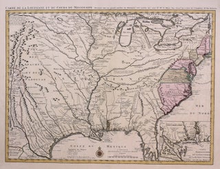
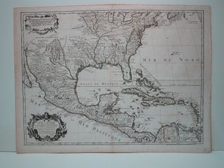
Amsterdam: Covens & Mortier, 1730. Notes: With an inset, titled "Carte Particuliere des Embouchures de la Riviere S.Louis et de la Mobile". "This map was first issued by Guillaume de l'Isle in 1718, the illustration showing a close copy, published in Amsterdam during the 1740's. The detail of this Covens.....
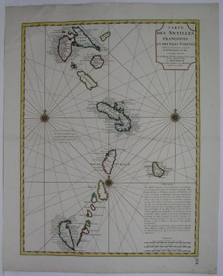
Amsterdam: Covens, Jean & Mortier, Corneille, 1730. Size : 601x458 (mm), 23.625x18 (Inches), Coloring: Original Outline Coloring, Category: ; Maps West Indies Whole. Size : 601x458 (mm), 23.625x18 (Inches), Coloring: Original Outline Coloring, Category: ; Maps West Indies Whole.
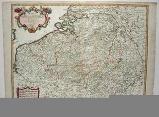
Paris: 1702. Size : 477x627 (mm), 18.75x24.625 (Inches), Coloring: Original Outline Coloring, Category: ; Maps Europe Benelux. Size : 477x627 (mm), 18.75x24.625 (Inches), Coloring: Original Outline Coloring, Category: ; Maps Europe Benelux.
Paris: Buache, P, 1745. Notes: Delisle, G. "Atlas", [1700-1704], No. 26 De L'Isle, well known map of the West Indies and Southern U.S., reworked by his relative and successor Phillippe Buache who was the great exponent of theoretical geography in France. Of note is the fact that the source of.....
Paris: 1782. Size : 990x660 (mm), 39x26 (Inches), Coloring: Hand Colored, Category: Maps South America Countries;. Size : 990x660 (mm), 39x26 (Inches), Coloring: Hand Colored, Category: Maps South America Chile; Maps South America Argentina; Maps South America Paraguay.
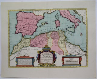
Amsterdam: Covens, Jean & Mortier, Corneille, 1740. Size : 397x540 (mm), 15.625x21.25 (Inches), Coloring: Original Hand Coloring with some hand colouring, Category: ; Maps Mediterranean Sea; Maps Europe Spain; Maps Africa North. Size : 397x540 (mm), 15.625x21.25 (Inches), Coloring: Original Hand Coloring with some hand colouring, Category: ; Maps Mediterranean.....
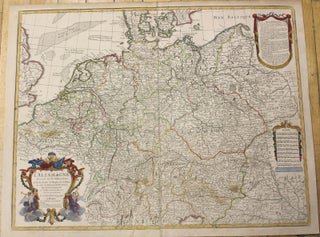
Paris: 1701. Size : 485x630 (mm), 19.125x24.75 (Inches), Coloring: Hand Colored, Category: ; Maps Europe Germany. Size : 485x630 (mm), 19.125x24.75 (Inches), Coloring: Hand Colored, Category: ; Maps Europe Germany.
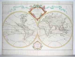
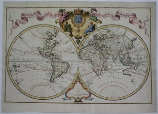
Paris: 1700. Size : 438x665 (mm), 17.25x26.125 (Inches), Coloring: Original Outline Coloring, Category: Maps World. Size : 438x665 (mm), 17.25x26.125 (Inches), Coloring: Original Outline Coloring, Category: Maps World.
Amsterdam: Covens & Mortier, 1747. Size : 488x575 (mm), 19.25x22.625 (Inches), Coloring: Hand Colored, Category: ; Maps Europe Balkans; Maps Europe Greece, Macedonia. Size : 488x575 (mm), 19.25x22.625 (Inches), Coloring: Hand Colored, Category: ; Maps Europe Balkans; Maps Europe Greece, Macedonia.
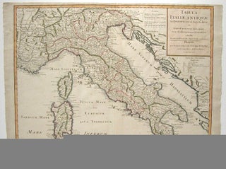
Paris: 1715. Size : 490x634 (mm), 19.25x25 (Inches), Coloring: Original Outline Coloring, Category: ; Maps Europe Italy. Size : 490x634 (mm), 19.25x25 (Inches), Coloring: Original Outline Coloring, Category: ; Maps Europe Italy.
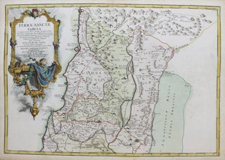
Paris: 1763. Notes: with a decorative cartouche in the top left., Size : 343x490 (mm), 13.5x19.25 (Inches), Coloring: Original Hand Coloring, Category: ; Maps Asia Middle East Holy Land & Palestine. Notes: with a decorative cartouche in the top left., Size : 343x490 (mm), 13.5x19.25 (Inches), Coloring: Original Hand Coloring.....
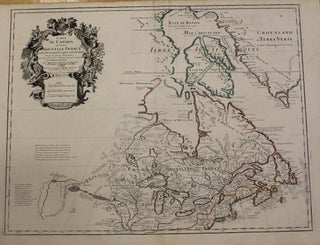
Paris: 1703 but 1718. Notes: Fifth State. Scarce. "Del'Isle's map of Canada is one of the most outstanding maps of Canada of the 17th and early 18th centuries. Typical of all of his work, the information that went into his map of Canada was the result of careful and painstaking.....
The Netherlands: c. 1760. Notes: Engraved by Jacob van der Schley. It depicts the coast of Mozambique and an early projection of the course of the Zambezi and Limpopo Rivers; giving us an impression as to how present-day Zimbabwe, northeastern South Africa, Swaziland, and Mozambique were thought to look like......
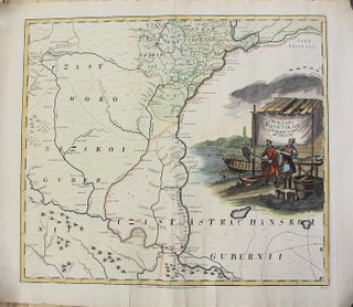
St. Petersburg: Entworffen bey der Kayserl. Academie der Wissenschaften, 1745. Notes: Map showing Volga River Region in Russia. L'Isle, Joseph Nicolas de, 1688-1768. Kirilov, Ivan Kirillovich, 1689-1737. The map has a large decorative cartouche depicting fishermen across Volga river., Size : 498x560 (mm), 19.61x22.05 (Inches), Coloring: Original Hand Coloring, Category.....
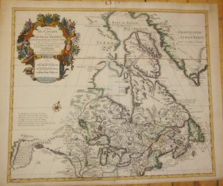
Amsterdam: Covens & Mortier, 1730. Notes: Second state. "De L'Isle's careful research resulted in the first mpa of Canada to present the whole of the Great Lakes correctly. In addition, the postion of the lakes relative to Hudson Bay is also correct, and the Avalon Peninsula is shown much more.....
Amsterdam: 1730. Size : 445x685 (mm), 17.5x27 (Inches), Coloring: Hand Colored in Outline, Category: Maps World. Size : 445x685 (mm), 17.5x27 (Inches), Coloring: Hand Colored in Outline, Category: Maps World.