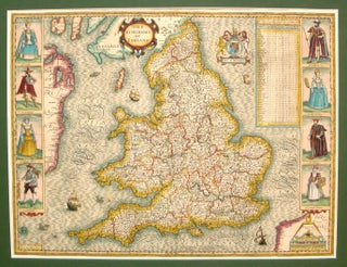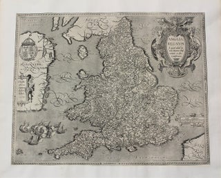
Anglia, Regnum si quod aliud in toto Oceano ditissimum et florentissimum
Antwerp, Belgium: c.1603. Notes: Important map of United Kingdom by Ortelius based on an earlier map by Christopher Saxton in 1579., Size : 384x483 (mm), 15.12x19.02 (Inches), Coloring: Hand Colored, Category: Maps Europe United Kingdom England; Maps Europe Ireland; Maps Europe United Kingdom Wales;. Notes: Important map of United Kingdom.....