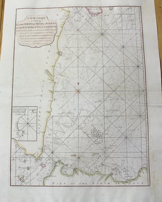
A New Chart for Sailing Between The Straits of Sunda or Batavia, And The Straits of Banca and Gaspar.
London: Laurie & Whittle, 1794. Notes: With an inset map: " Plan of the Bay Between North Island & the Three Sisters by Capt.Lestock Wilson"., Size : 670x492 (mm), 26.38x19.37 (Inches), Coloring: Hand Colored, Category: Maps Asia South East Indonesia & Papua New Guinea;. Notes: With an inset map: ".....