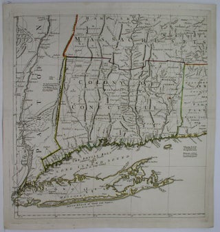
A Map of the most Inhabited Part of New England Containing the Provinces of Massachusetts Bay, New Hampshire and the Colonies of Connecticut and Rhode Island.
London: c. 1777. Notes: This is the lower left sheet of the four sheet map. The map depicts all of Long Island, the Hudson River through the Colony of Connecticut, and to the western part of Rhode Island. It extends to include the southwestern part of Massachusetts. This map provides.....