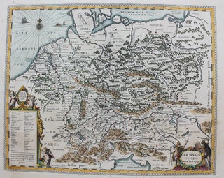
Germaniae Veteris Nova Descriptio
Amsterdam: c.1657. Notes: A finely detailed and superbly coloured map of Germany stretching from Dacia to Gaul and from the Adriatic Sea to the Baltic Sea during the 17th century. The map shows cities and towns (represented by various buildings), geographical features, and even decorates bodies of water with ships.....