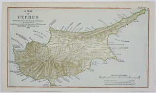
A Map of Cyprus
London: 1877. Size : 140x250 (mm), 5.5x9.875 (Inches), Category: Maps Mediterranean Islands;. Size : 140x250 (mm), 5.5x9.875 (Inches), Category: ; Maps Mediterranean Cyprus.
London: 1877. Size : 140x250 (mm), 5.5x9.875 (Inches), Category: Maps Mediterranean Islands;. Size : 140x250 (mm), 5.5x9.875 (Inches), Category: ; Maps Mediterranean Cyprus.

Weimar, Germany: Geographisches Institut, c.1853. Notes: A detailed map of Turkey, including the Caucasus, Iraq and Iran, during the mid 19th century. There is an inset map of Lebanon. The map shows major cities, roads, borders, and geographical features., Size : 535x658 (mm), 21.06x25.91 (Inches), Coloring: Original Outline Coloring, Category.....